

From astronomy to geography |
Click here for other design errors |
Move the cursor over the small pictures for an enlarged view
Missing country ! Austria, between Germany and Italy, was completely forgotten ! |
 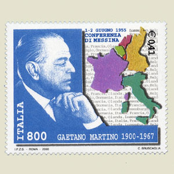  | |
ITALY 2001 | |
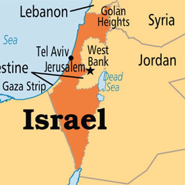
Forgotten Gazah territory. Stamp issued to show the Arab solidarity against the expansion of Israel into occupied territories. But one of these territories, the territory of Gazah, was represented on this stamp as belonging to Israel ! |
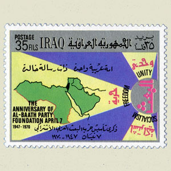  | |
IRAQ 1970 | |
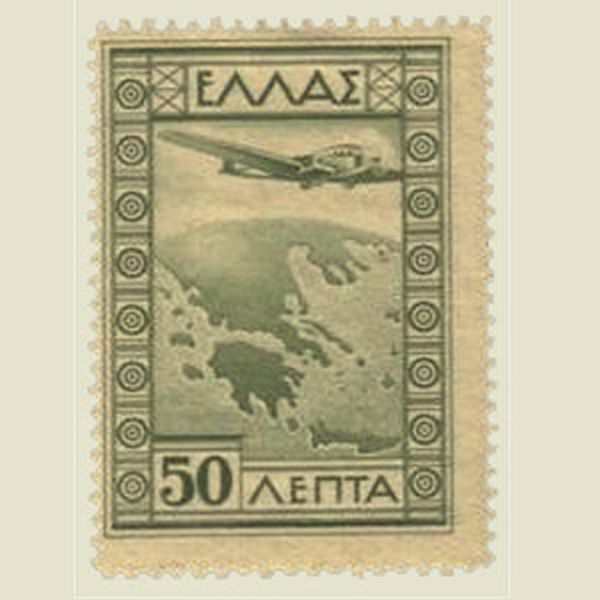
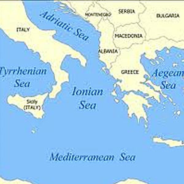
Greece as a continent Greece became a whole continent. But where is the rest of Europe ? |
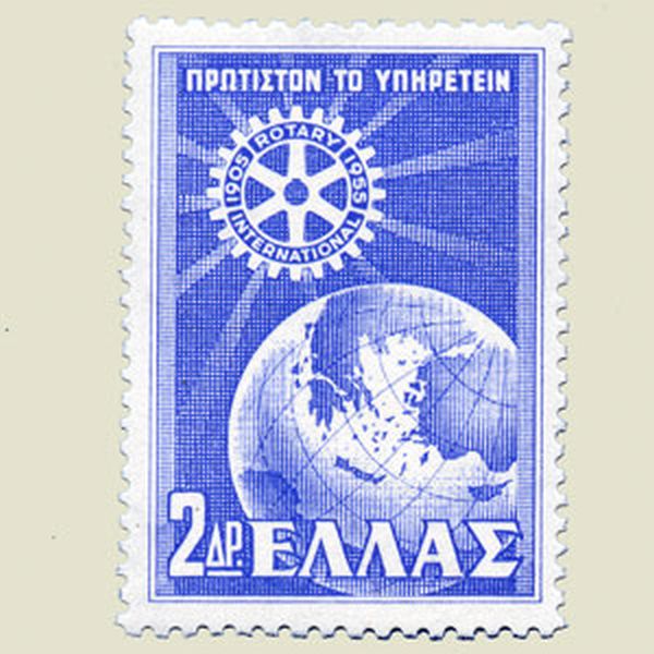 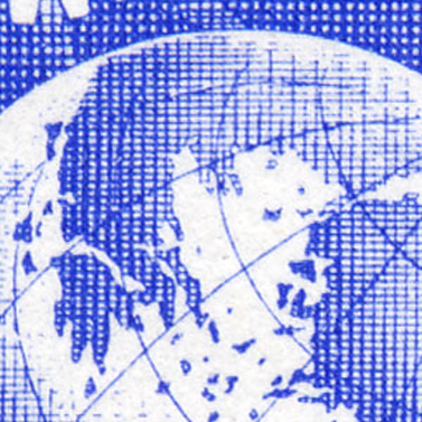 | |
GREECE 1956 | |
Wrong map If this map is correct the Persian Gulf will reach till the Mediterranean sea. |
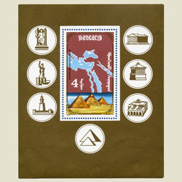 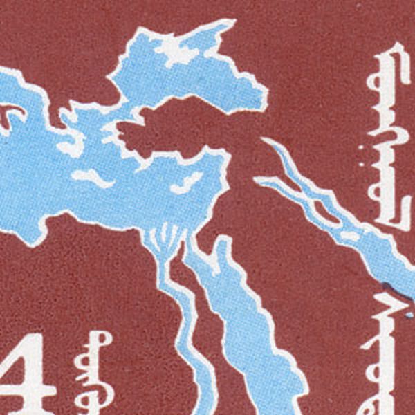 | |
MONGOLIA | |
Wrong map On the map the Istrian province of Yugoslavia was wrongly annexed by Italy. |
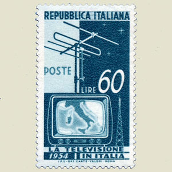 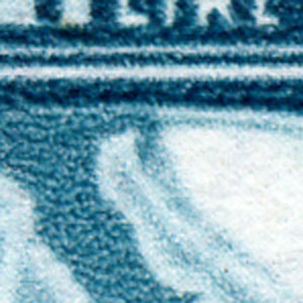 | |
ITALY 1954 | |
Wrong map The Agalega islands were wrongly added to the Sechelles. This was corrected, together with a better position of the Aldabra-islands. |
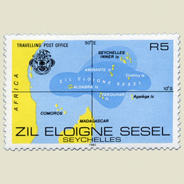 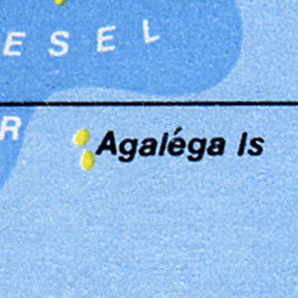 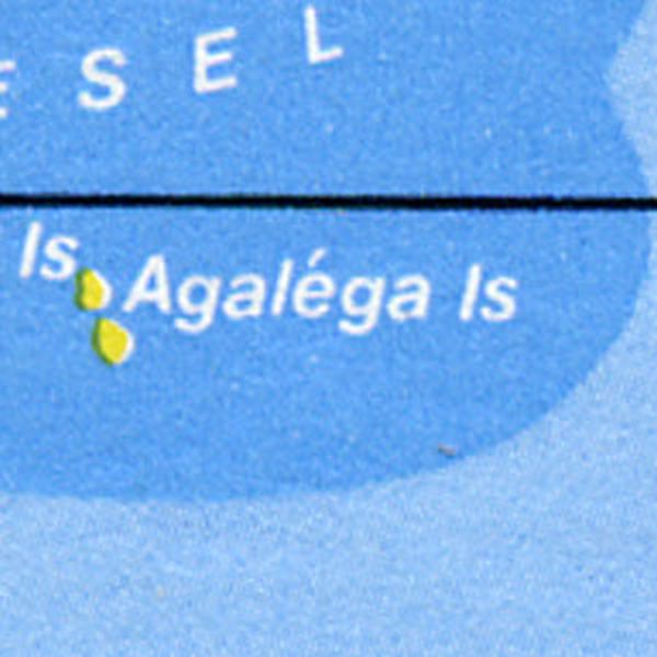 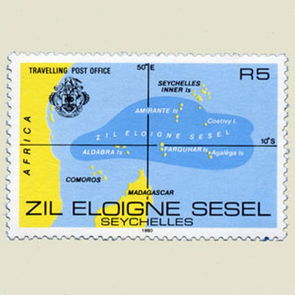 | |
SEYCHELLES 1980 | |
Wrong map A first stamp showed a map of the islands with the very important 180° longitude line unlabelled. This was corrected two years later. |
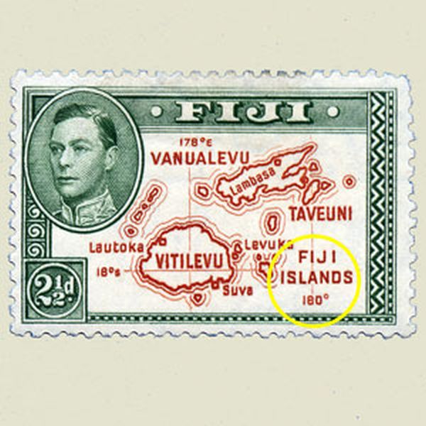 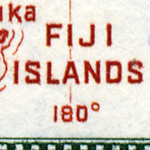 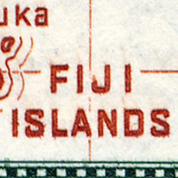 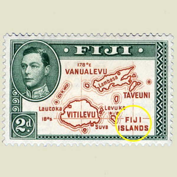 | |
FIJI 1938 | |
Wrong map A longitude of 40°30 North would have positioned the Guernsey island near Madrid. A corrected stamp was issued with the correct position 49°30N. |
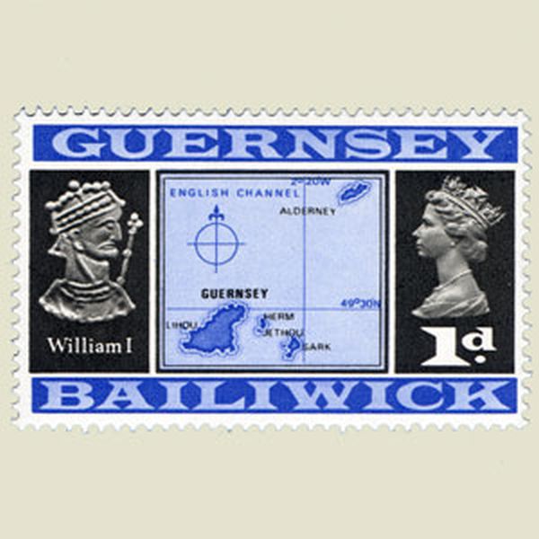 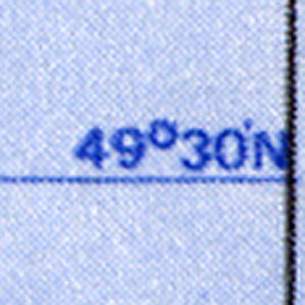 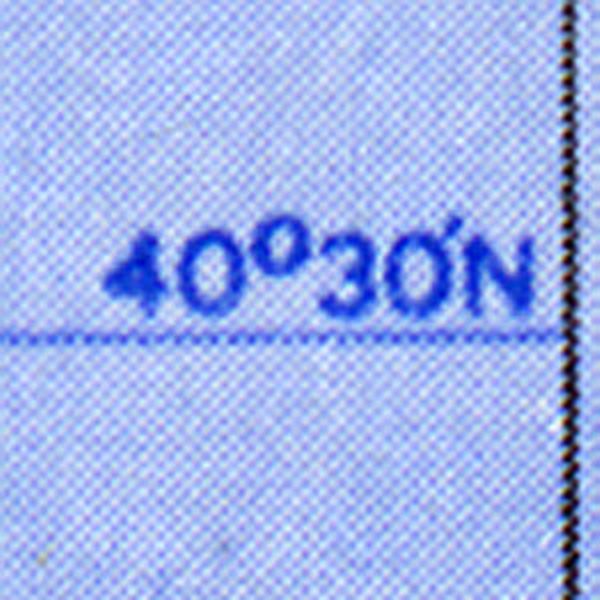 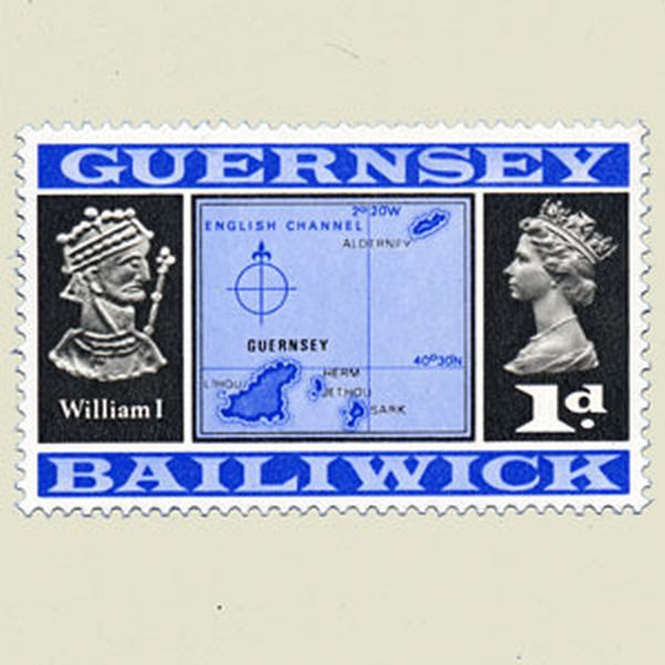 | |
GUERNSEY 1969 | |
Incorrect position. On the blue stamp the small islands Toku and Fonulei were wrongly depicted near Vava'u. The blue stamp shows their correct position. |
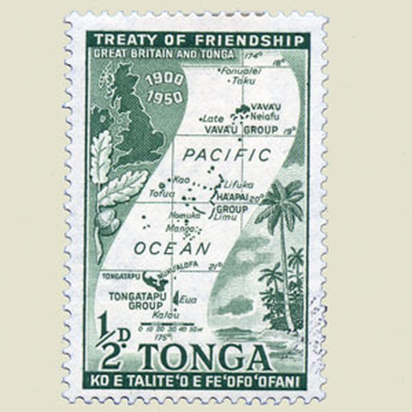 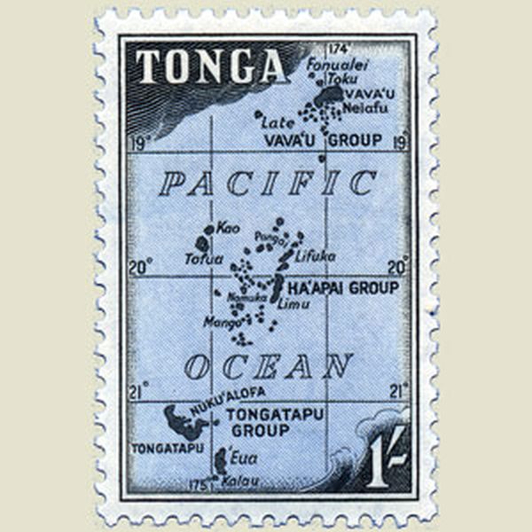 | |
TONGA 1953 | |
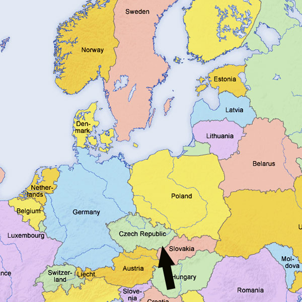
Wrong map Stamp issued for the entrance of 10 new countriesinto the European Union. Cyprus appears to have been relocated (and takes the place of the island of Crete. Some borders are missing (Norway/Sweden ...) |
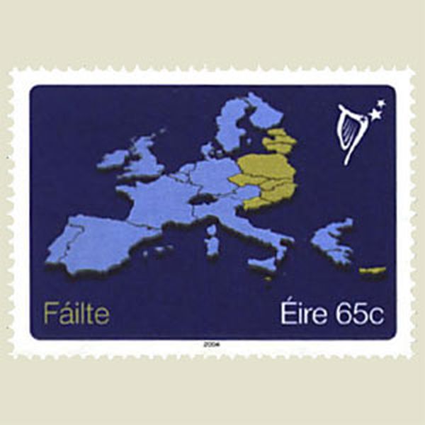  | |
IRELAND 2002 | |
Two errors Stamp showing a real game between Capablanca and Lasker, played in New York in 1924. However the black bishop should be on KN1, not on KB1. Furthermore, the landmasses on the globe in the background have no relation to actual contours. |
 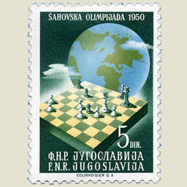 | |
YUGOSLAVIA 1950 | |
Wrong map Hopefully the participants of this sailing contest did not navigate according to this map : where Rijeka is situated on the block, you will in fact find the town of Opatija. Rijeka is located almost in the Eastern corner of this map. |
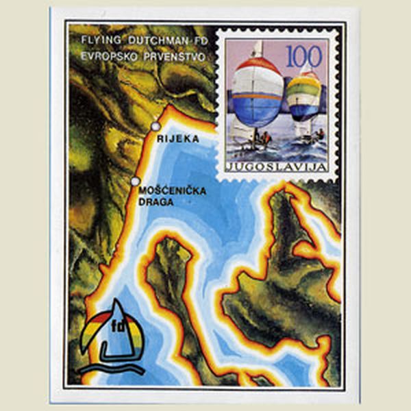 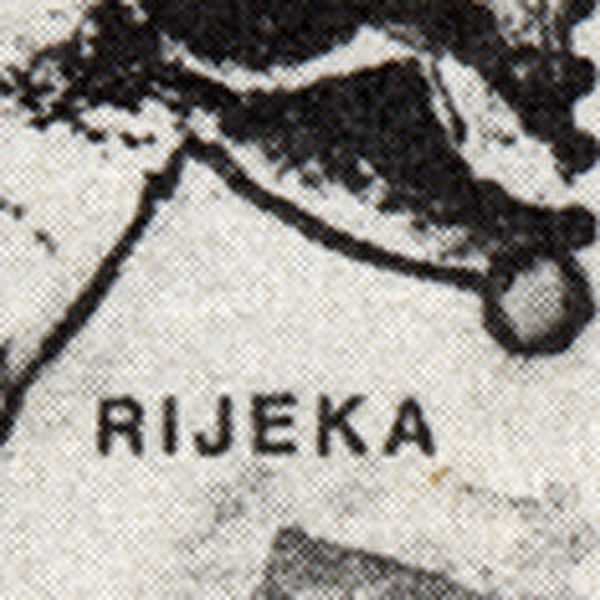 | |
YUGOSLAVIA 1986 | |
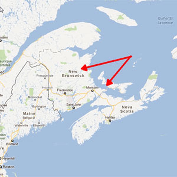
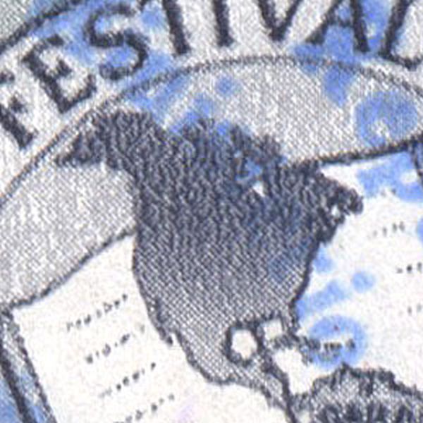
Wrong map On the map, Nova Scotia appears to be attached to Gaspé Peninsula, New Foundland is badly misshaped, and Paris has been moved to the mouth of the Seine. |
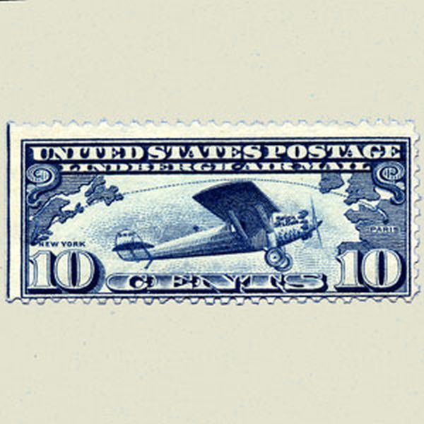 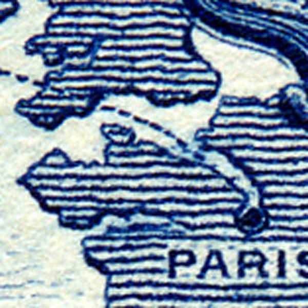 | |
UNITED STATES OF AMERICA 1927 | |
Wrong map Greenland has completely disappeared from the face of the earth |
  | |
UNITED STATES OF AMERICA 1931 | |
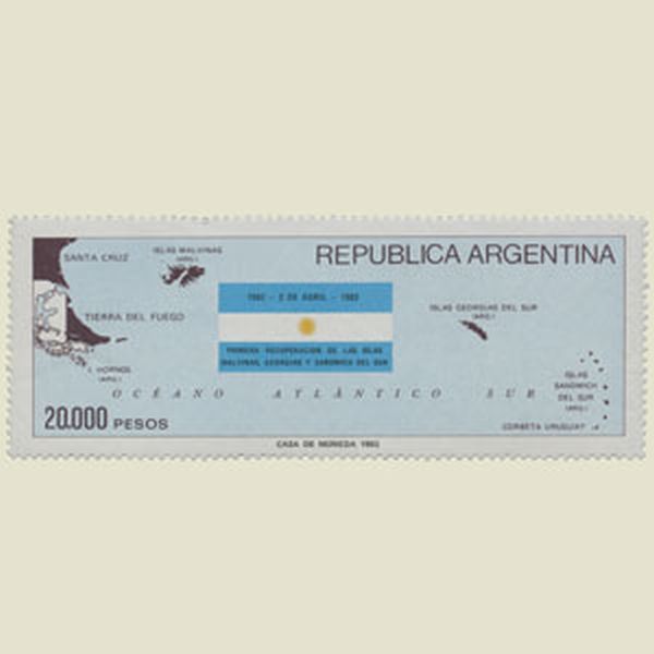
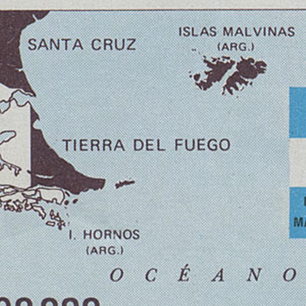
Wrong map ? Correct stamp for Argentina, as they claim the Falkland Islands, and of course wrong for Great Britain. |
  | |
ARGENTINA | |
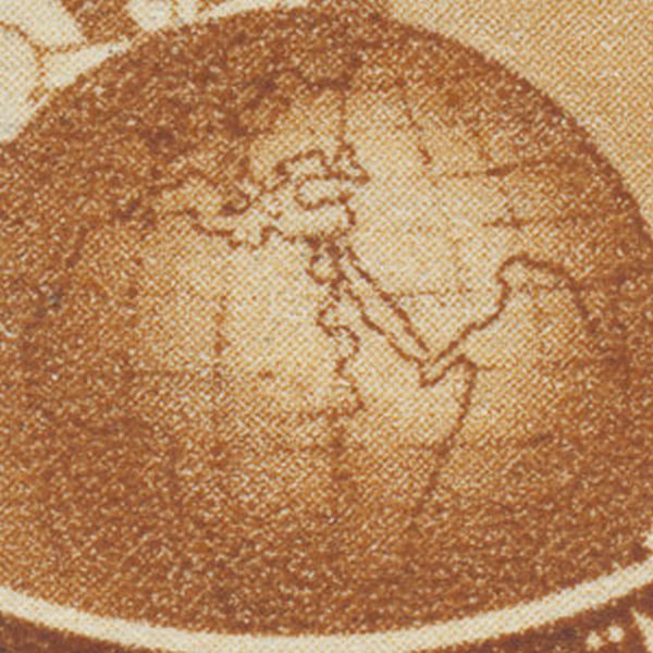
Wrong globe. Impossible to recognise the continents on this globe, they only exist in the imagination of the designer. |
Non-error ? |
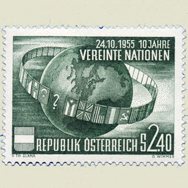 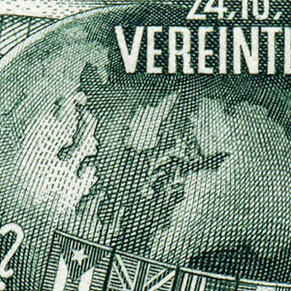 | |
AUSTRIA 1955 | |
Hidden map The clouds and rocks are disposed to show the map of Bohemia, before it was invaded by the Nazis. The engraver was sent to a concentration camp, and a new stamp was issued. |
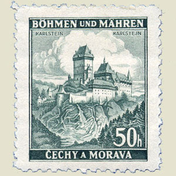 | |
BOHEMIA 1939 | |
Potential conflict Both Bolivia and Paraguay claimed the Chaco-region. Some years after those stamps were issued, they tried to solve the conflict by arms. |
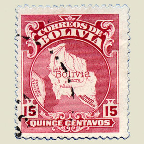 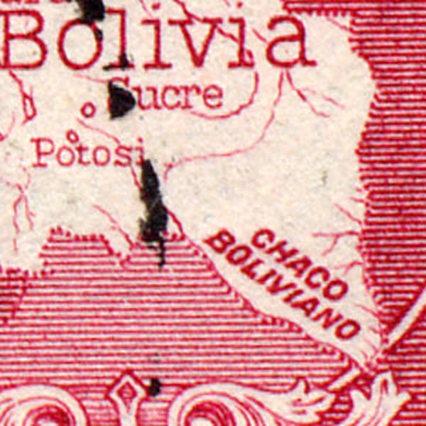  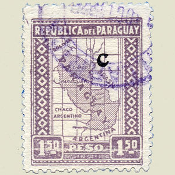 | |
BOLIVIA 1935 | |
Wrong map Taiwan is pictured at least 10 times bigger as mainland China. |
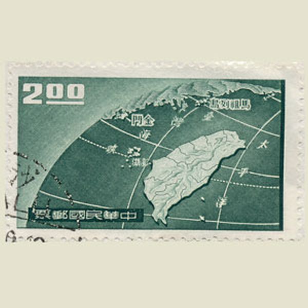 | |
TAIWAN 1959 | |
Inverted map Correct and mirrored map of the Dominican Island |
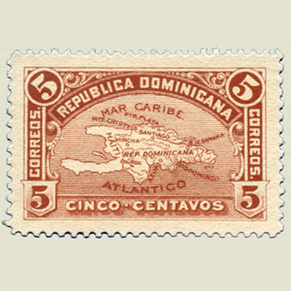 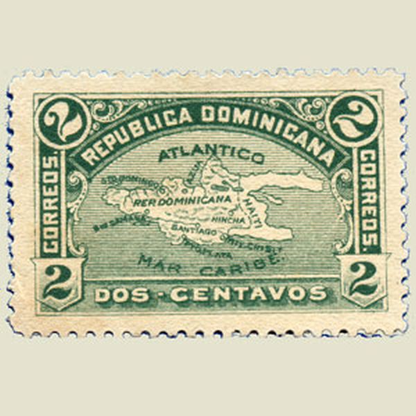 | |
DOMINICAN REPUBLIC 1900 | |
Wrong map The Persian Gulf has completely disappeared on this stamp |
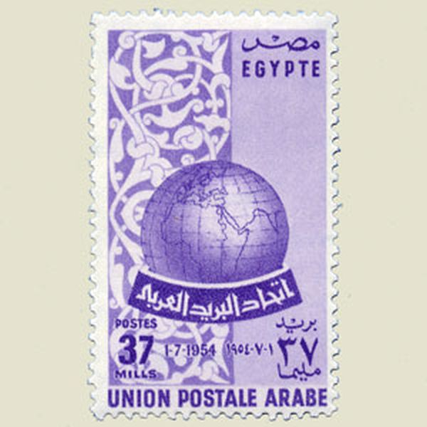 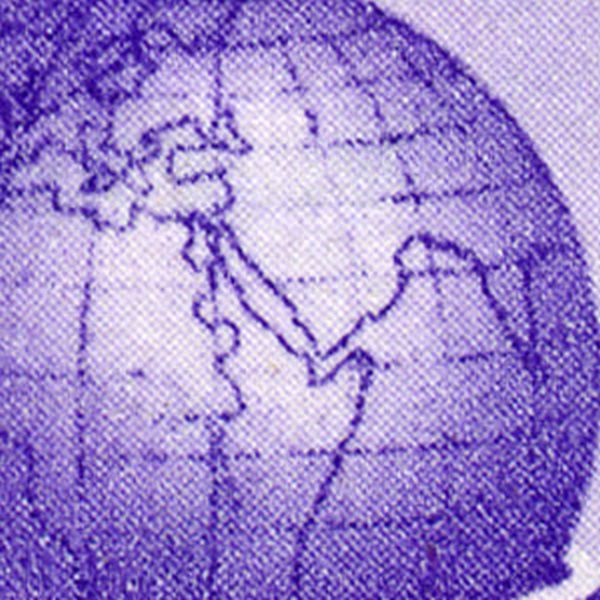 | |
EGYPT 1954 | |
Wrong map On the stamp, the Nothern exit of the Suez canal touches Lake Manzala. In fact, the canal passis directly into the Mediterranean. |
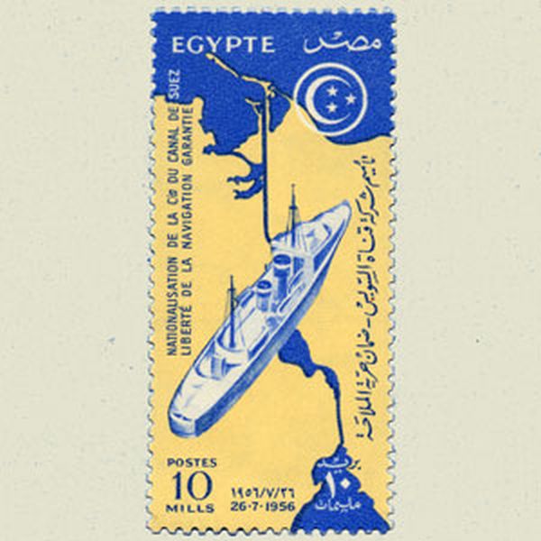 | |
EGYPT 1957 | |
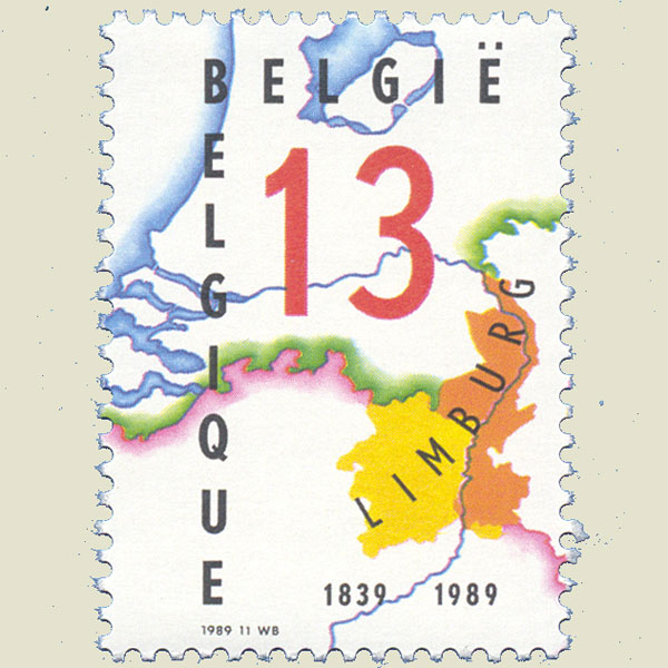
Wrong borders Non correct borders on the colored part of the map. Was corrected. |
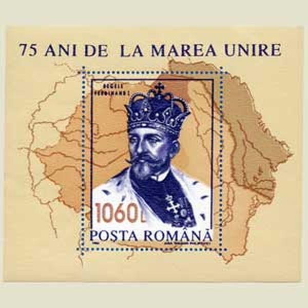  | |
ROMANIA 1993 | |
Forgotten countries. England and Ireland seem to have been forgotten on this map. |
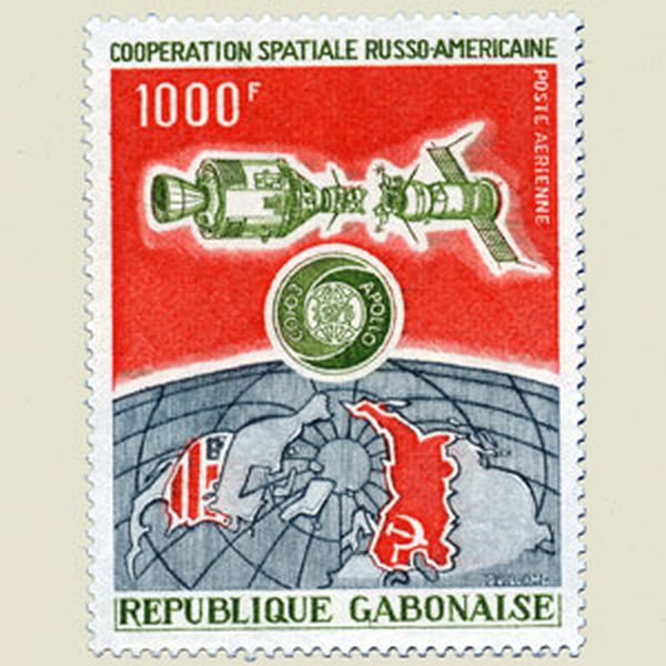  | |
GABON 1974 | |
Upside down. This map was pictured upside down, with the nord at the bottom of the design. |
 | |
GERMANY 1969 | |
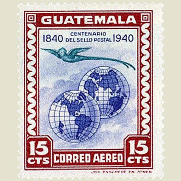
Territory extension. Belice (British Honduras) has disappeared, and has been integrated in Guatemala. A correct stamp, however, was issued some years before. |
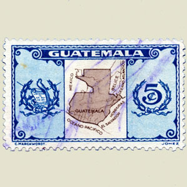 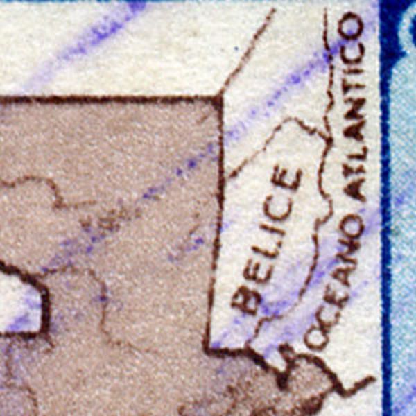 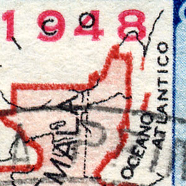 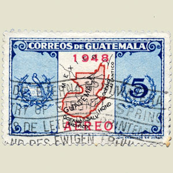 | |
GUATEMALA 1948 | |
Wrong map. Pink stamp issued to commemorate the visit of the Italian president to Peru. A wrong map was issued by the designer. To avoid diplomatic incidents, a new grey stamp with corrected map was issued. Some stamps, however, were already in circulation. This stamp, unfortunately for me, is a forgery. |
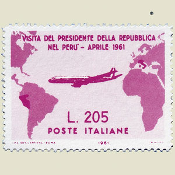   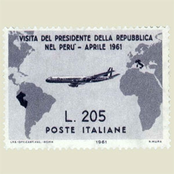 | |
ITALY 1961 | |
Wrong map. Gotha, Vienna, Rome and Madrid are misplaced on this map. |
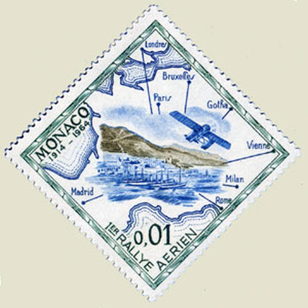 | |
MONACO 1964 | |
Partial correction. Cape Bauld was wrongly located on the Nord of Cape Norman, instead of South of it. The error was corrected but another error 'Straits of Belle Isle' instead of 'Strait of Belle Isle' was forgotten. |
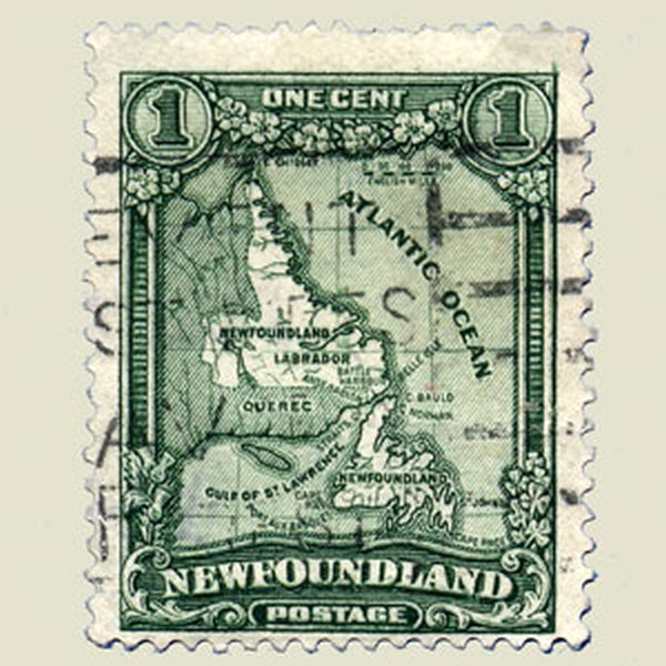 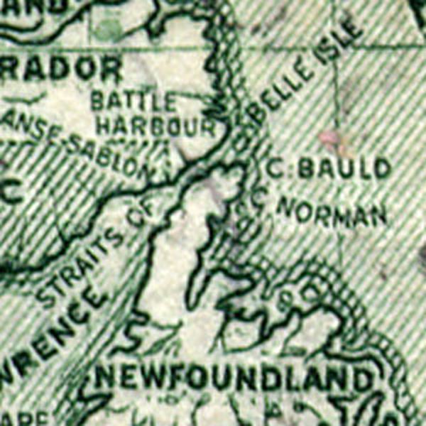 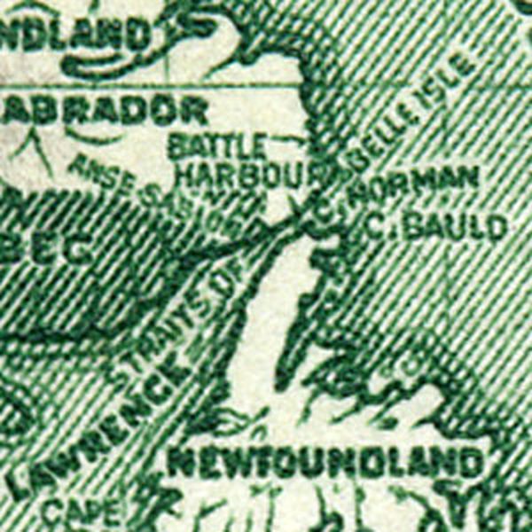 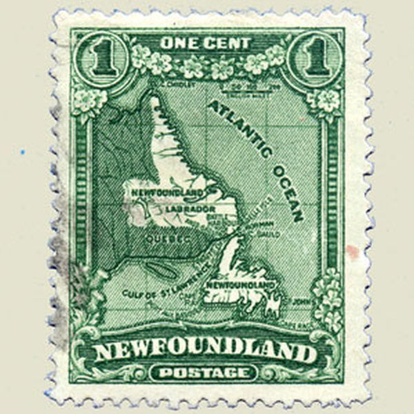 | |
NEWFOUNDLAND 1928 | |
Wrong location The location 166°E was wrongly shown as 166°E. |
 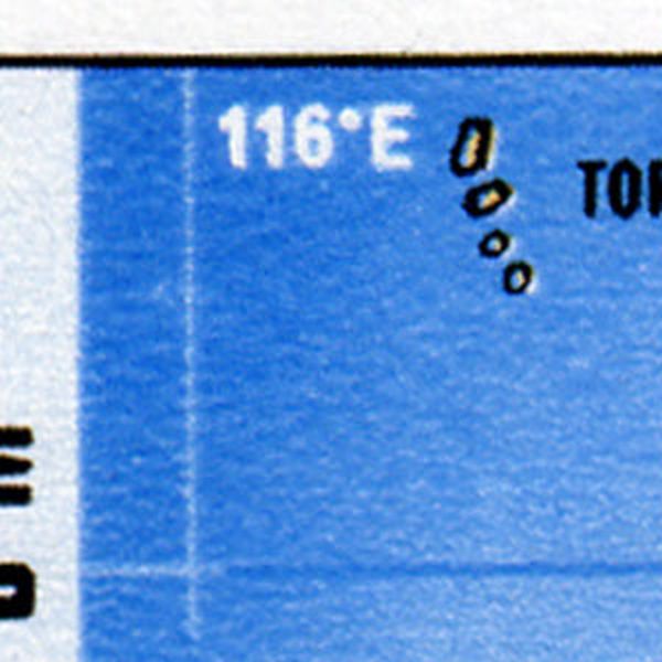 | |
NEW HEBRIDES | |
Partial correction. The wrong position 21°10S was corrected in 20°10S. But 57°30E was wrong too, and was surprisingly not corrected in 57°10E |
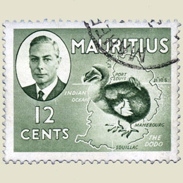 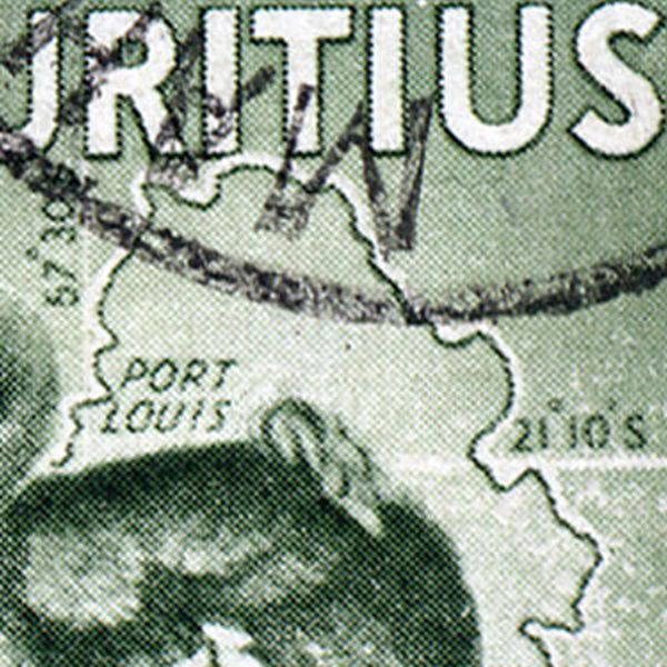 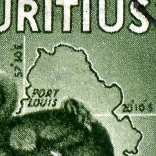 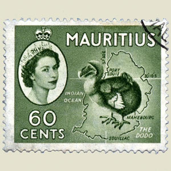 | |
MAURITIUS 1950 | |
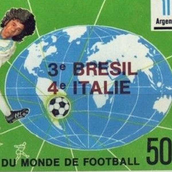
Wrong country The winner of a golden medal, pictured on this stamp, was a Norwegian from Oslo. He has no direct link with … STOCKHOLM ! |
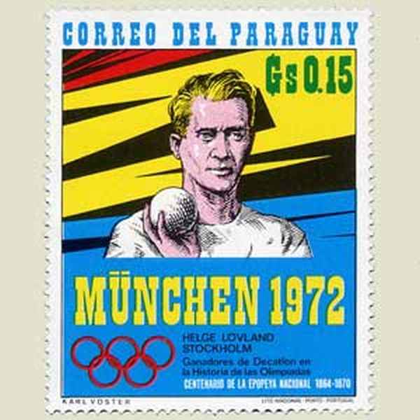 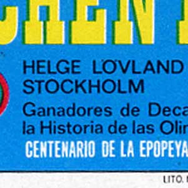 | |
PARAGUAY 1972 | |
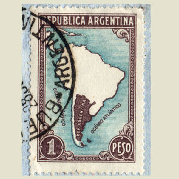
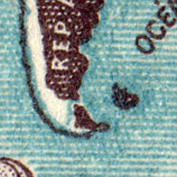
Wrong map Map of the Antarctica, with missplaced longitudes 110W and 120W |
 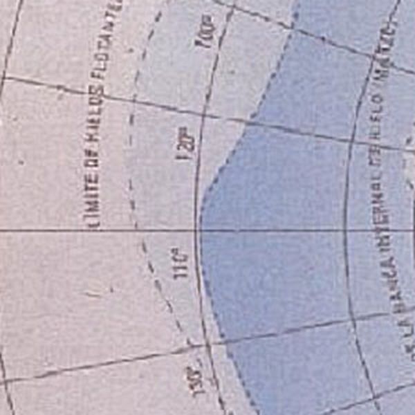 | |
ARGENTINA | |
Reversed map. The map in the circle is reversed. Wheb the stamp itself is reversed, the map appears correctly. |
  | |
HUNGARY | |
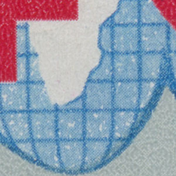
Wrong landscape The wrong skyline of the mountains was corrected by issuing a new stamp. |
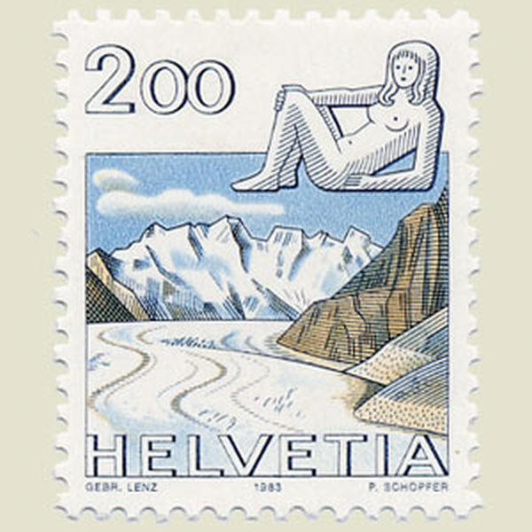 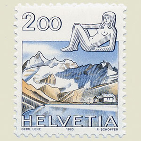 | |
SWITZERLAND 1983 | |
Missing island The island of Madagascar is missing |
    | |
TOGO | |
Name inversion Inversion of the names of Bosnia Herzegovina and Croatia |
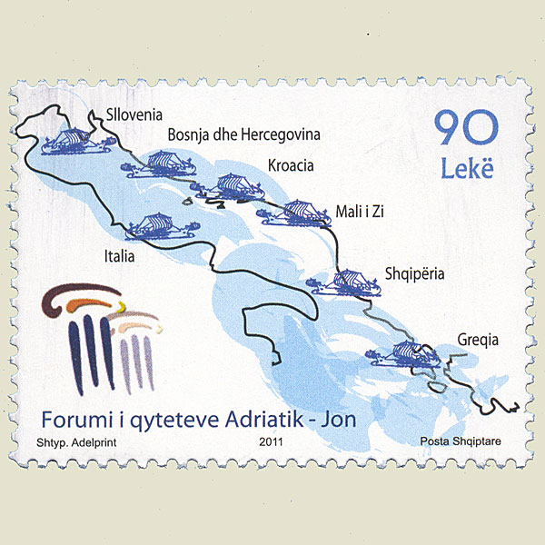 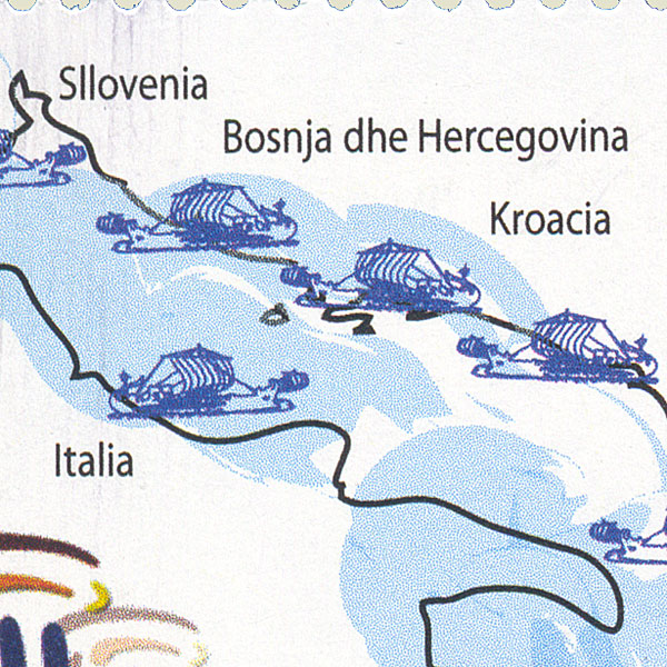  | |
ALBANIA 2011 | |
Diplomatic incident Diplomatic iincident between Turkey and Armenia, when Armenia issued a stamp with mount Ararat. This mount is indeeed located in Turkey.. |
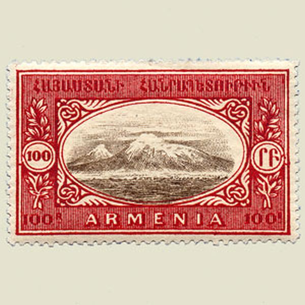 | |
ARMENIA 1920 | |
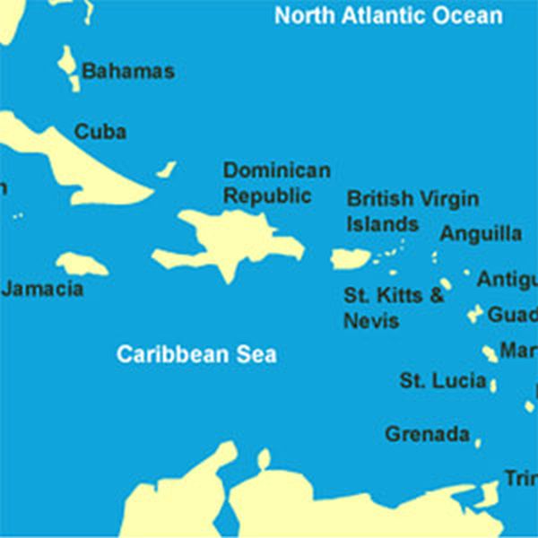
Other territory The islands right below do not belong to the Bahamas, but to the Turks and Caicos islands |
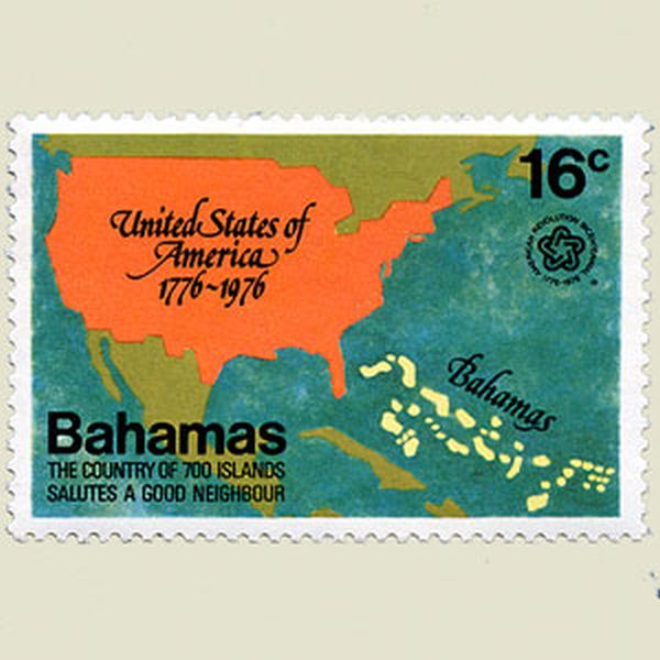 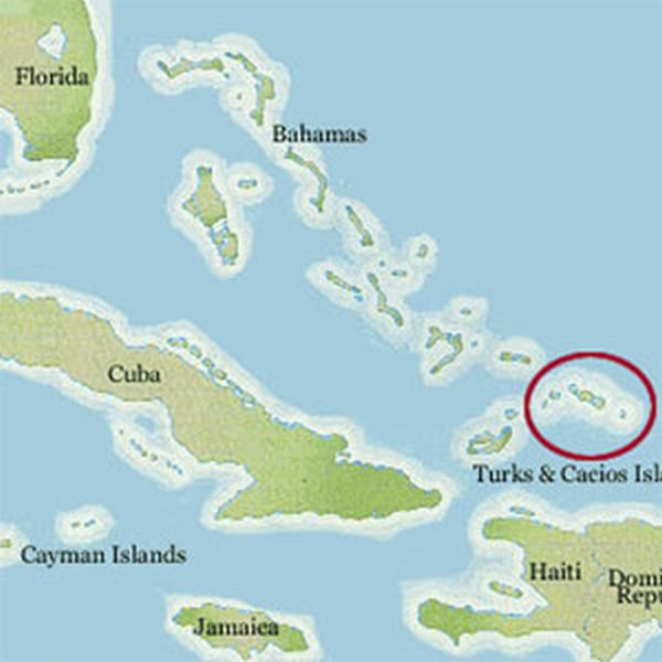 | |
BAHAMAS 1976 | |
Wrong map Jamaica was brought into the picture where San Domingo, a much bigger island ought to be. |
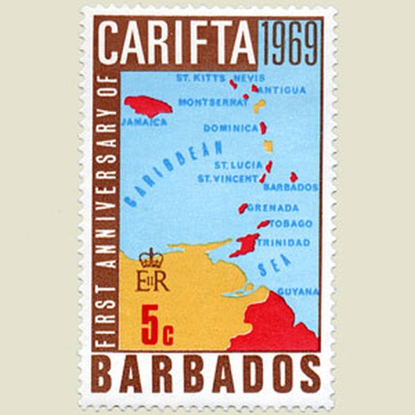 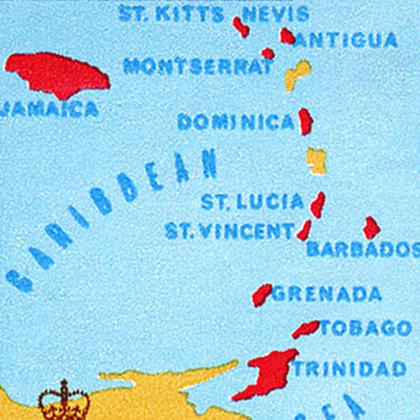  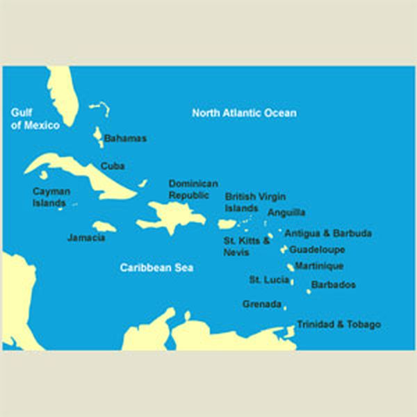 | |
BARBADOS 1969 | |
Annexation The red color is covering more than the half of Finland |
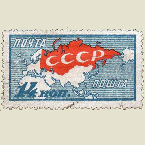 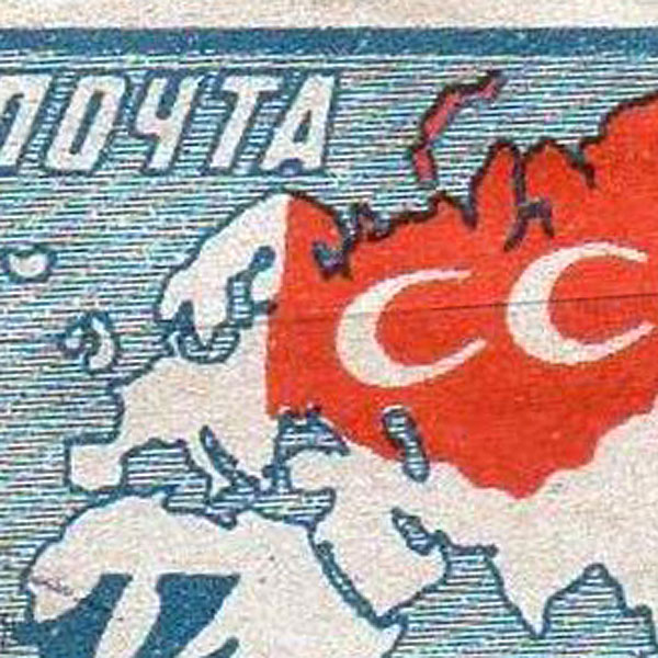 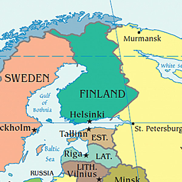 | |
RUSSIA 1927 | |
Political statement It is obvioous that the country that issued yhis stamp did not recognize the state Israël. |
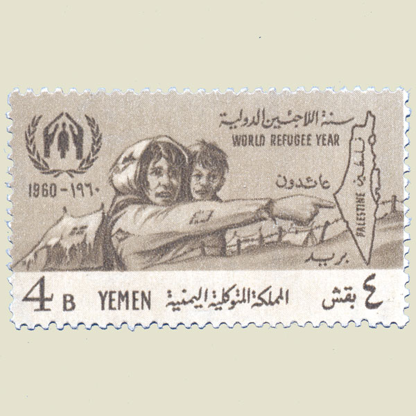 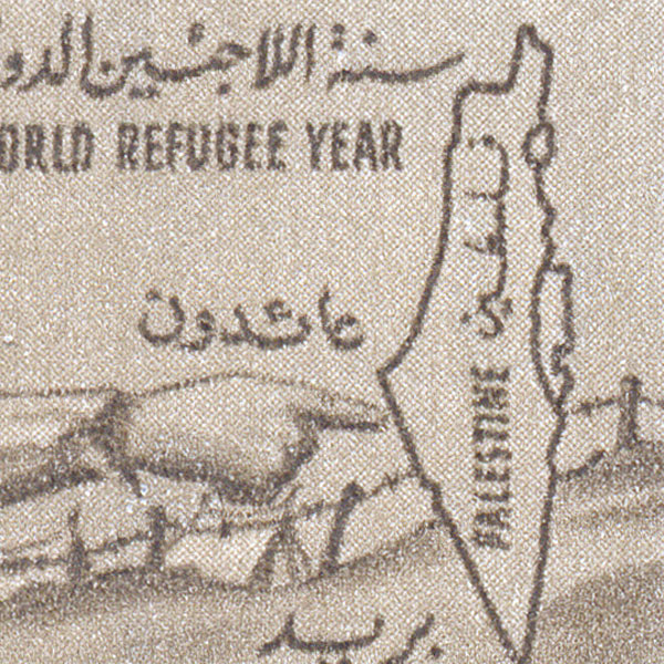  | |
YEMEN 1960 | |
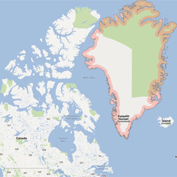
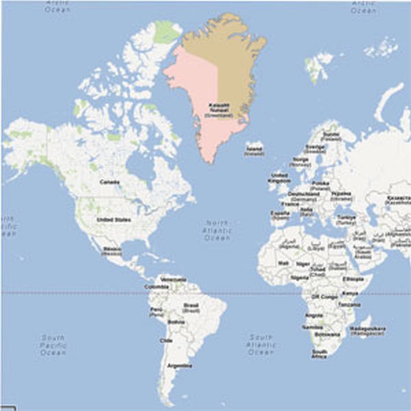
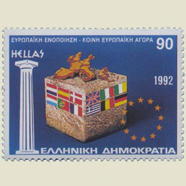
Missing countries Greenland and Iceland are missing on this stamp.gr |
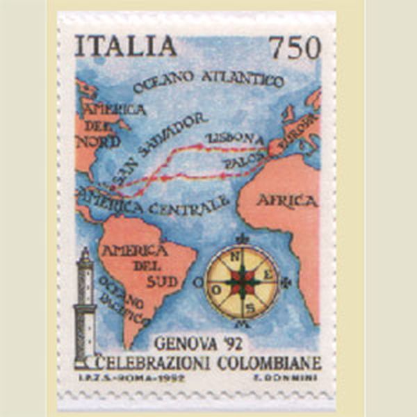 | |
ITALY 1992 | |
Missing countries Greenland and Iceland were forgotten. |
 | |
ITALY 1953 ? | |
Missing border Missing border between the Czec Republic and Slovakia, independent countries since 1992. |
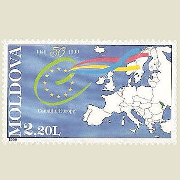   | |
MOLDOVA 1999 | |
Wrong position on map The location of the city of Perdasdefogu is not correct |
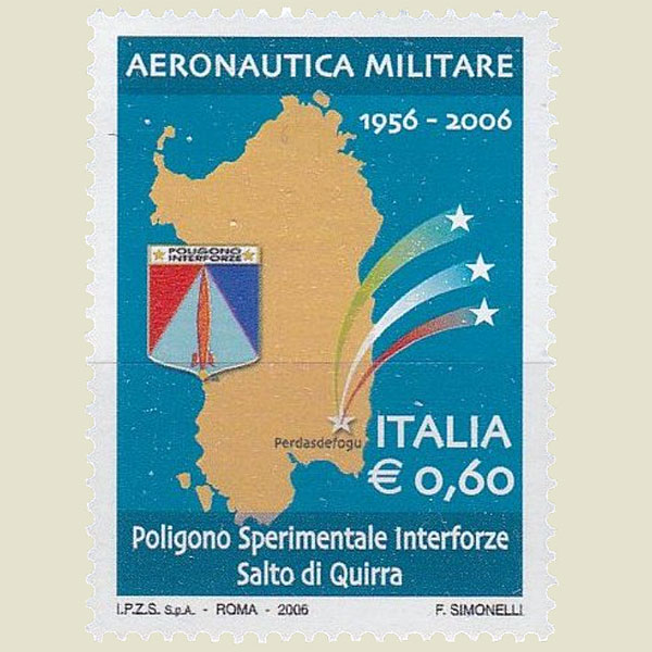 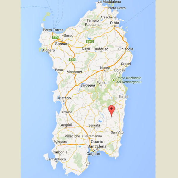 | |
ITALY 2006 | |
Wrong place Flensburg is situated in SCHLESWIG. Correct on stamp, but the FDC says put it in HOLSTEIN. |
 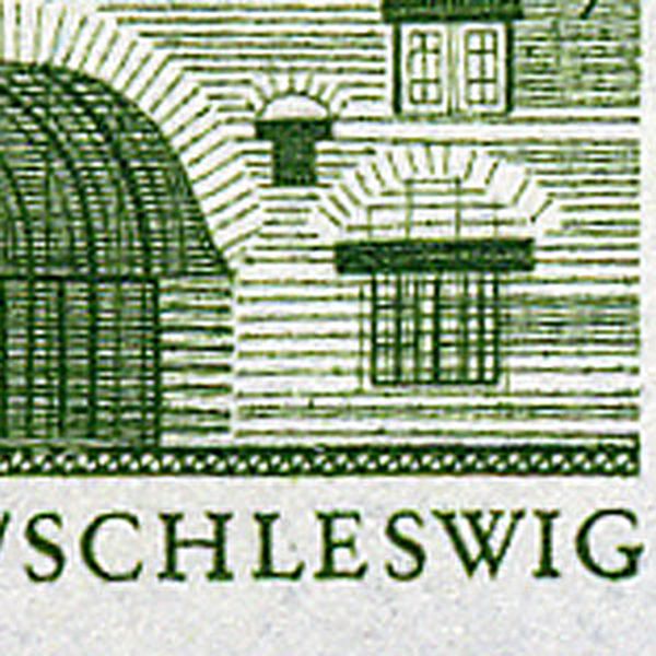 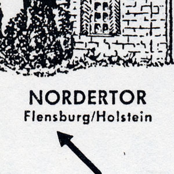 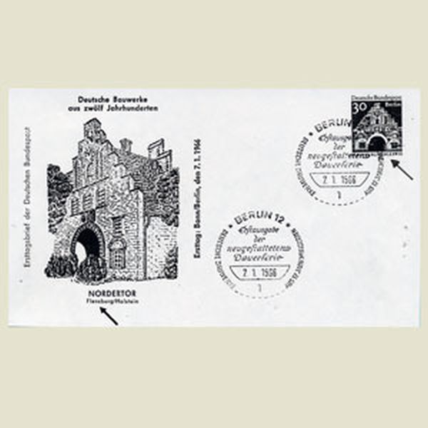 | |
GERMANY 1966 | |
Wrong map The map includes a territory between the rivers Orange and Molopo that belongs to the Republic of South Africa |
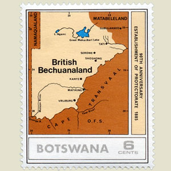 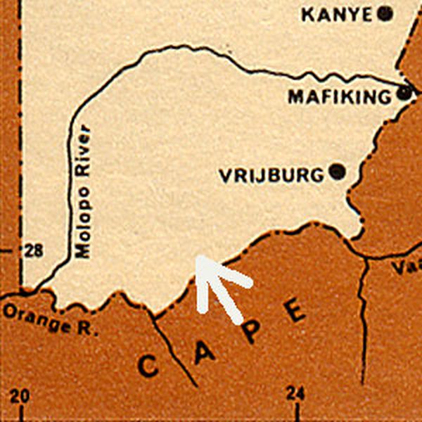 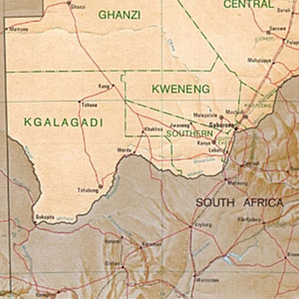 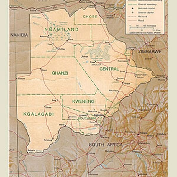 | |
BOTSWANA 1975 | |
Vaster than reality ! Some of the territories coloured in red did not belong to the British Empire. |
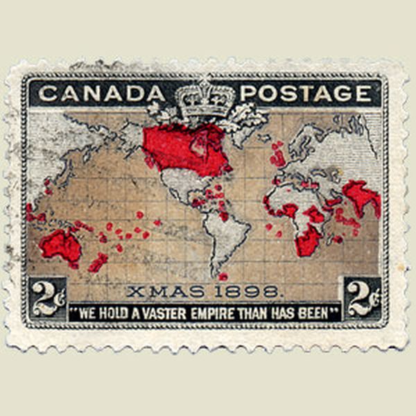 | |
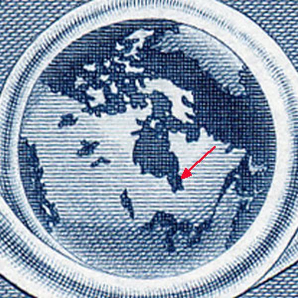
CANADA 1898 | |
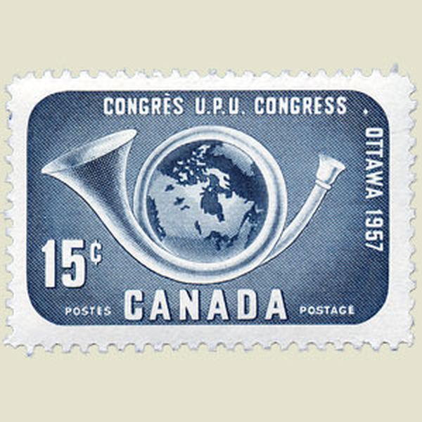
Wrong map The map showed on this stamp is larger than the one designed by Thompson, when he discovered those territories. |
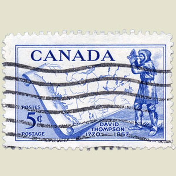 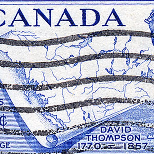 | |
CANADA 1957 | |
Flag and bay. The shape of the Hudson Bay is not correct (see other stamp). And there is no red line around the white part of the Canadian flag. |
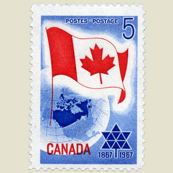    | |
CANADA 1967 | |
Not the first The Basilea map of 1540 was not the first map of America, The first map was published in an edition of the Polyhistor by Solinus, which Sebastian Munster edited and printed in Basel, 1538. |
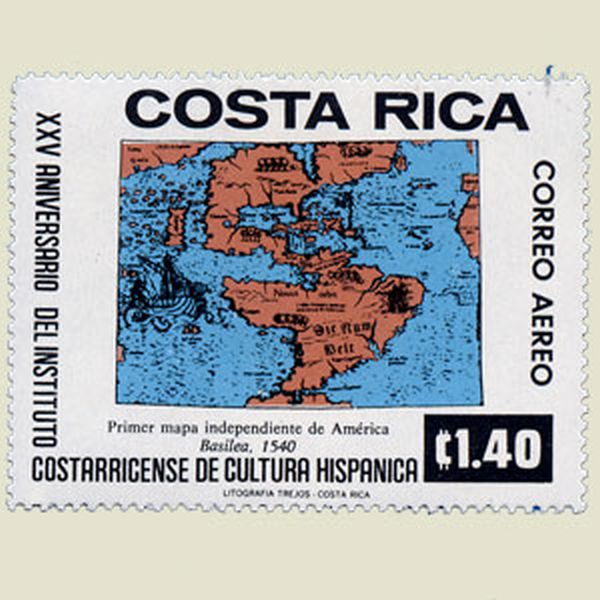 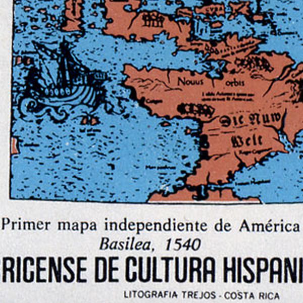 | |
COSTA RICA 1977 | |
Wrong map The places featured on this stamp are not in the right position. |
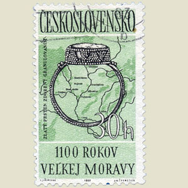  | |
CZECHOSLOVAKIA 1963 | |
Three errors Novia Scotia is pictured as an island, and the USA include the Province of Quebec south of the Lawrence River. And in the upper margin,Trans-Atlantic should have been Transatlantic. |
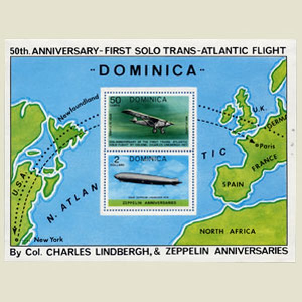 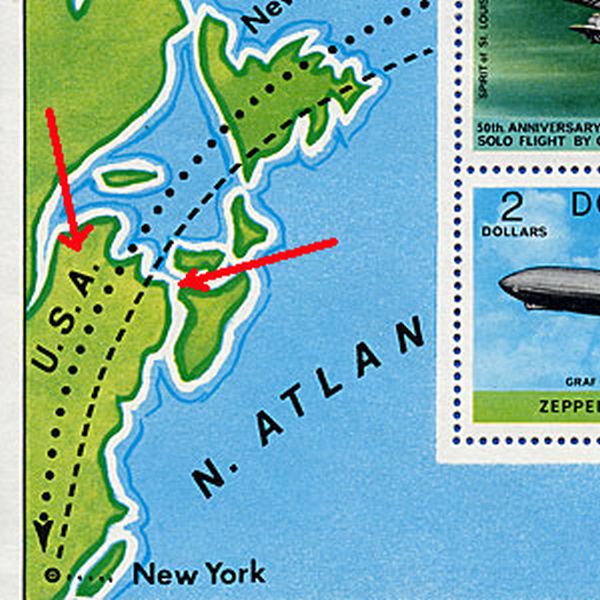 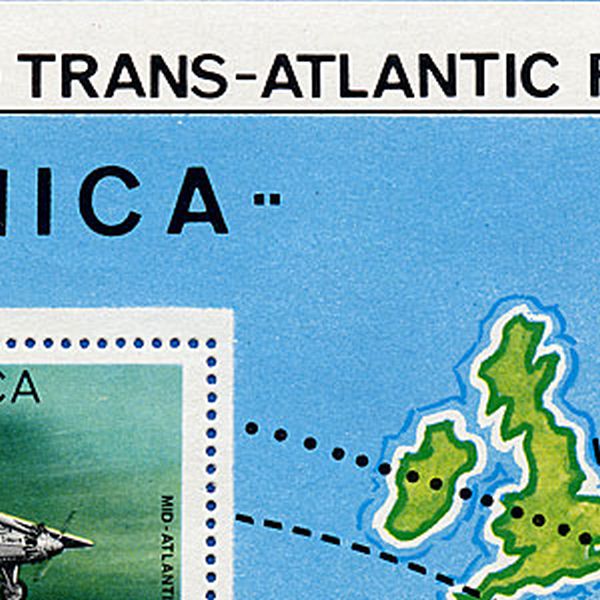  | |
DOMINICA 1977 | |
Correct It has been claimed that on this stamp the western degree of latitude was 6° instead of 61° : however a careful examination shows that the figure 1 is present, bu superimposed on the line itself. |
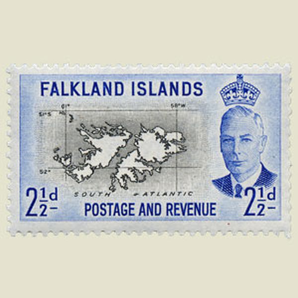 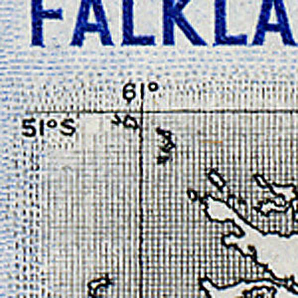 | |
FALKLAND ISLANDS 1952 | |
Forgotten The island of Madagascar was forgotten. |
  | |
SPAIN 1952 | |
Two little details The coast between Ceuta and Tanger is cut for more sharply on the stamp as in rerazlity. The Spanish town La Linea is wrongly shown as one single word. |
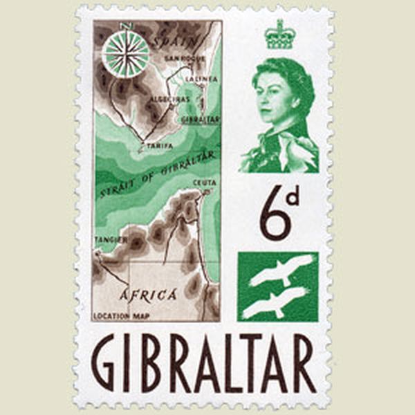 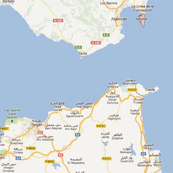 | |
GIBRALTAR 1960 | |
Error in map The cities Mahlanapeng and Mokhotlong have been transposed. |
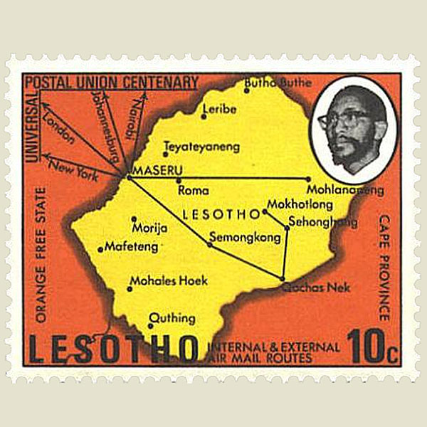 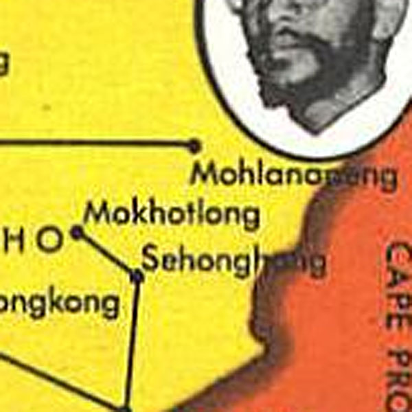 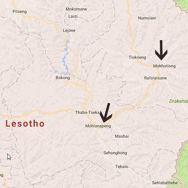 | |
LESOTHO 1974 | |
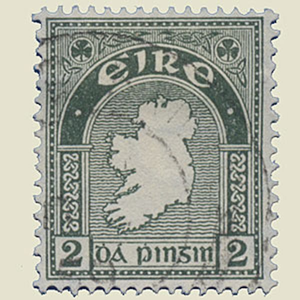
Wrong map This map is not quite correct as the northern part, Ulster, belonged in fact to Great Britain. |
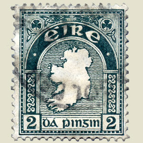 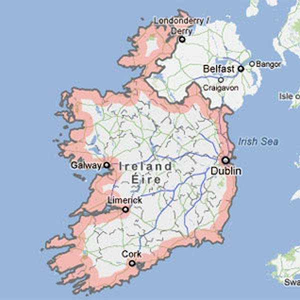 | |
IRELAND 1922 | |
Wrong map Greece covers a large part of the globe, ans the Peloponesis is featured as an island. |
 | |
GREECE | |
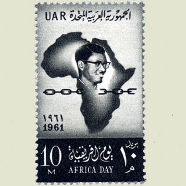
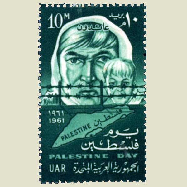
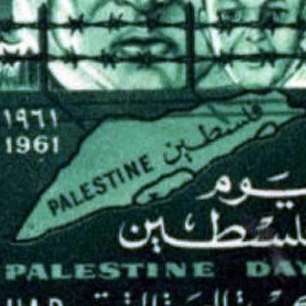
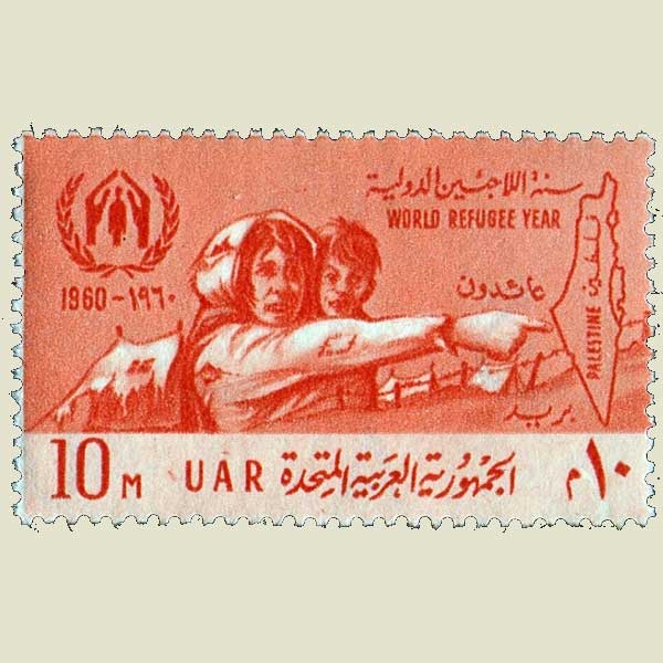
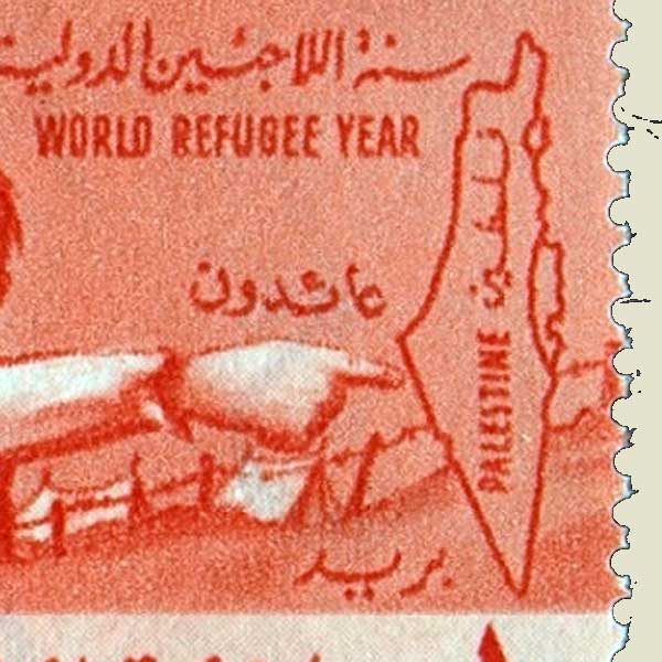
Annexation On this stamp Egypt gives away to Israel the complete Gazah stroke that belongs to Palestina. |
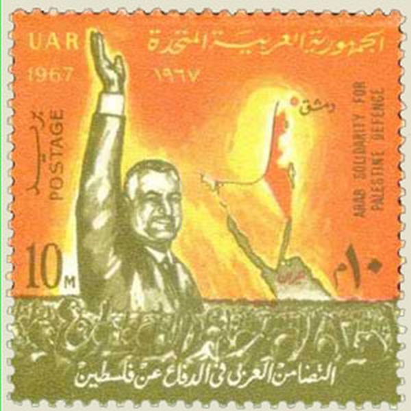  | |
UNITED ARAB REPUBLIC 1967 | |
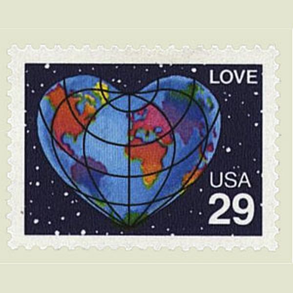
Missing countries Greenland and Iceland are missing on the map in the red heart. |
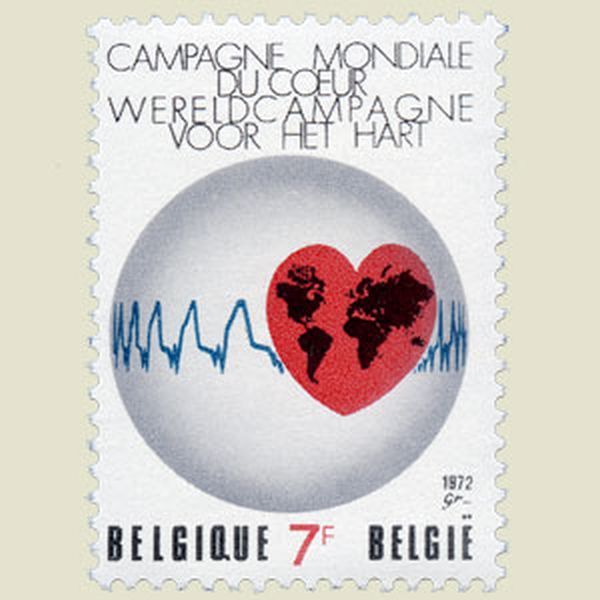 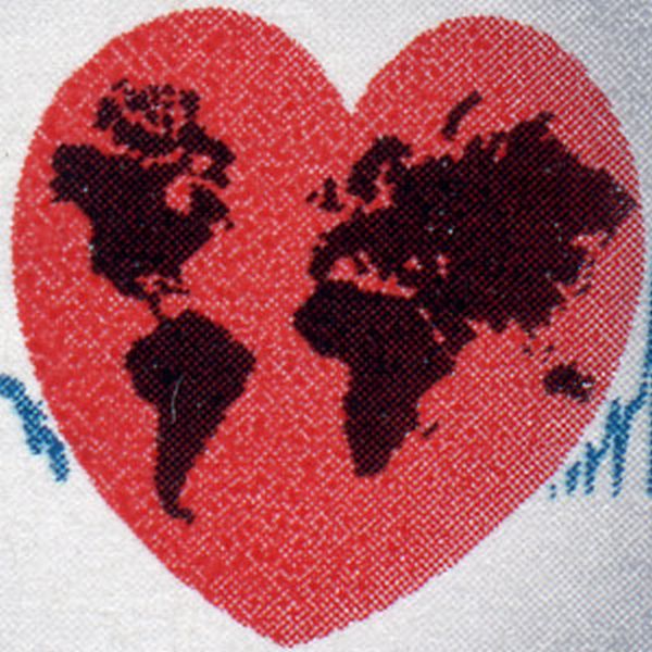   | |
BELGIUM 1972 | |
Wrong map The map of Estonia represents the situation before 1945, and includes two landstrips (Petersi and Narva) that now belong to Russia. |
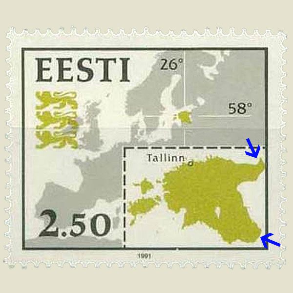 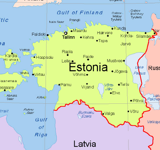 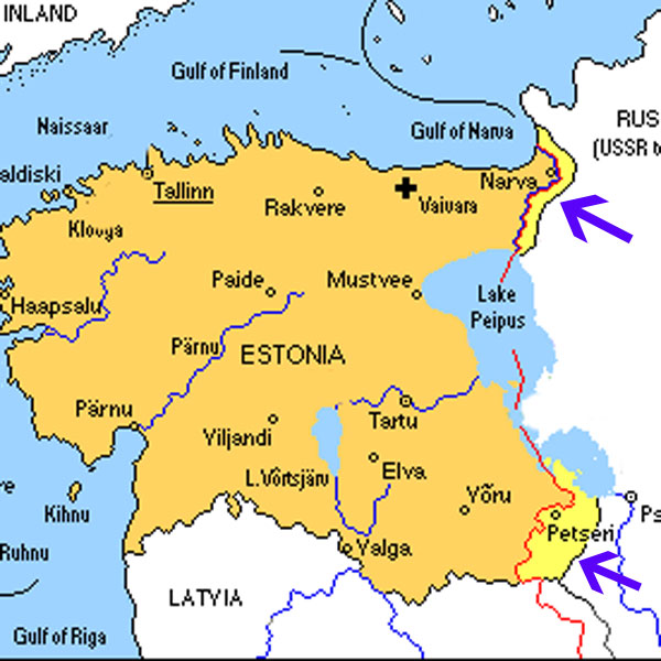 | |
ESTONIA 1991 | |
Missing continent Antartica was omitted on the two globes |
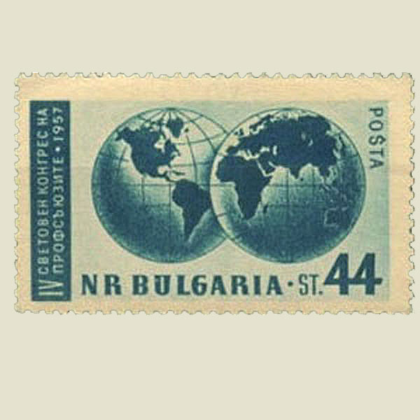 | |
BULGARIA 1957 | |
Missing continent and island. Antartica was omitted on both of the globes of this world map. The island of Madagascar has also disappeared. |
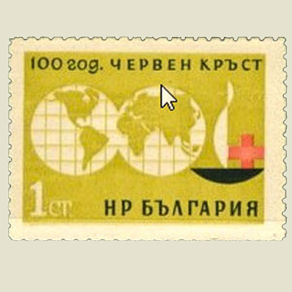 | |
BULGARIA 1964 | |
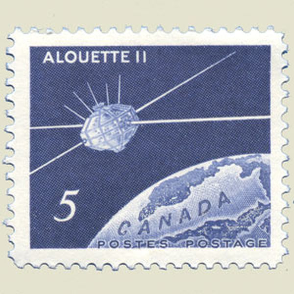
Forgotten continent Antartica was omitted |
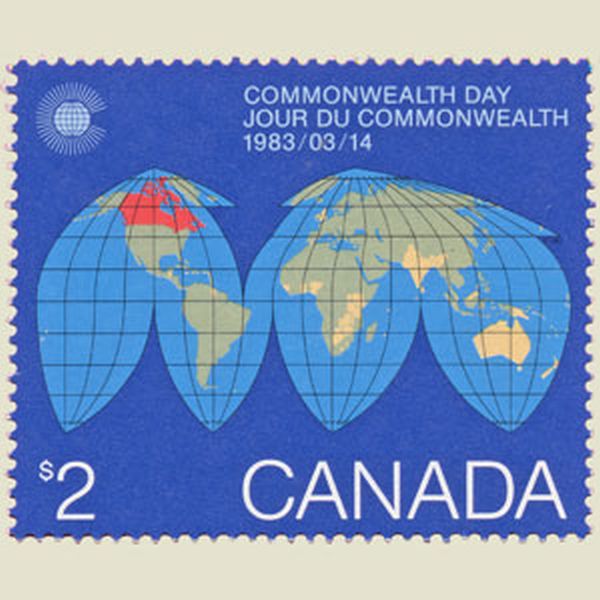 | |
CANADA 1983 | |
Forgotten islands Madagascar and Iceland were forgotten on this map. |
  | |
UNITED STATES OF AMERICA 1991 | |
Missing continent The Antarcic continent has been forgotten. |
  | |
UNITED STATES OF AMERICA | |
Out of proportion Iceland is much too big, and too close to Groenland and Europa |
 | |
ICELAND 1938 | |
Errors in map Errors in map : Ottawa located in the USA, Washington at the seaside. Corrected a year later. |
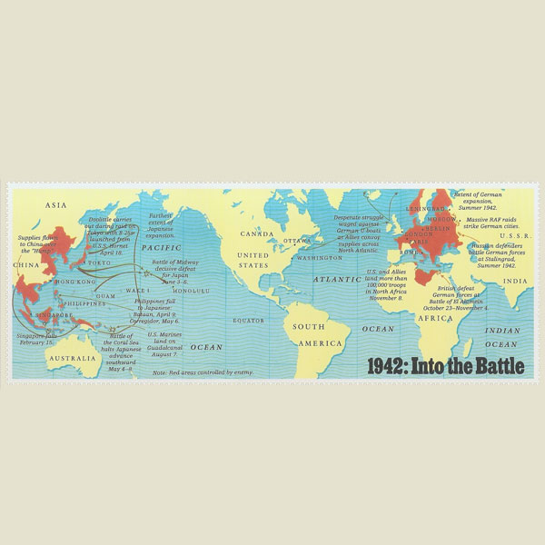 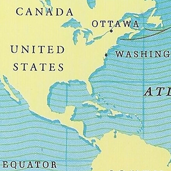 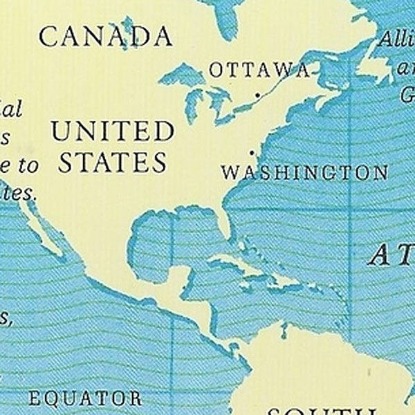  | |
UNITED STATES OF AMERICA 1992 | |
Claimed islands Matthews Island and Hunter Island are claimed by Vanuatu, but belong in fact to New Zealand |
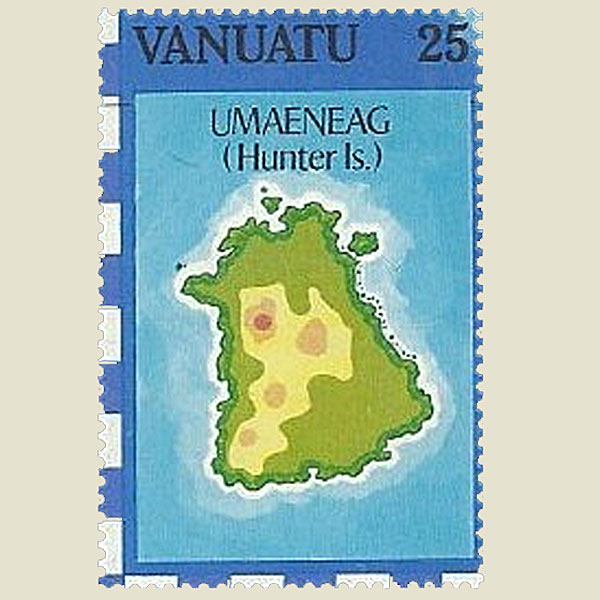 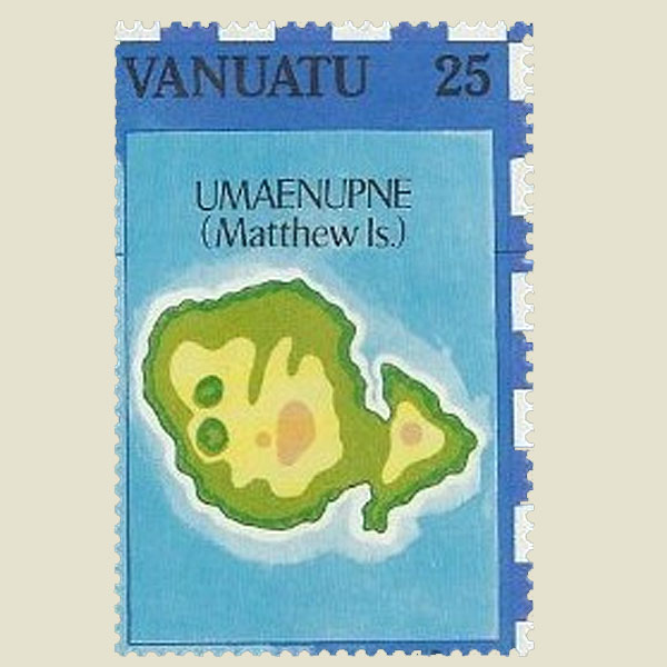 | |
VANUATU | |
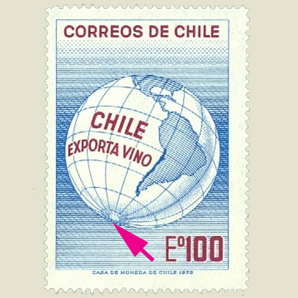
Missing continent Antartica is missing on this earthglobe. |
 | |
CHILE 1950 | |
Wrong map The Hudson Bay has almost completely disappeared. |
   | |
VENEZUELA 1956 | |
Not correct Madagascar and Iceland were forgotten, and Alaska is much too large. |
 | |
UNITED STATES OF AMERICA | |
Not correct The design of the East-coast of America is far from reality. |
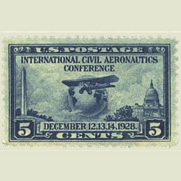 | |
UNITED STATES OF AMERICA 1928 | |
Wrong direction According to the map, the sun is rising in the Nord. |
  | |
TURKEY 1931 | |
Wrong country First stamp of Rwanda, showing wrongly a map of Burundi. |
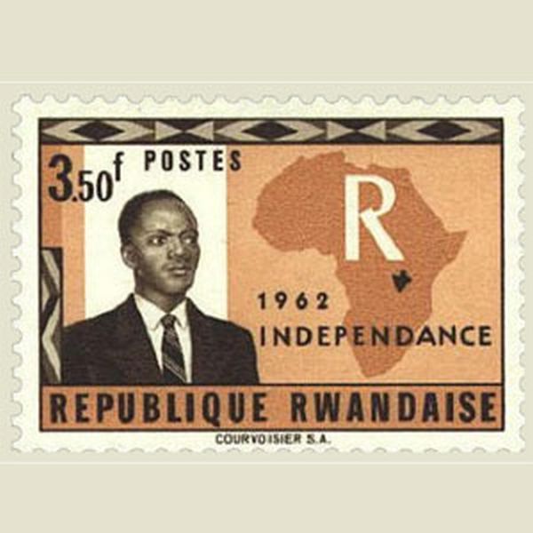 | |
RWANDA 1962 | |
Missing countries Greenland, Iceland and Antartica are missing. |
 | |
UNITED KINGDOM 1957 | |
Two errors Portugese instead of Portuguese Guinea. And the country name of Ivory Coast is missing. |
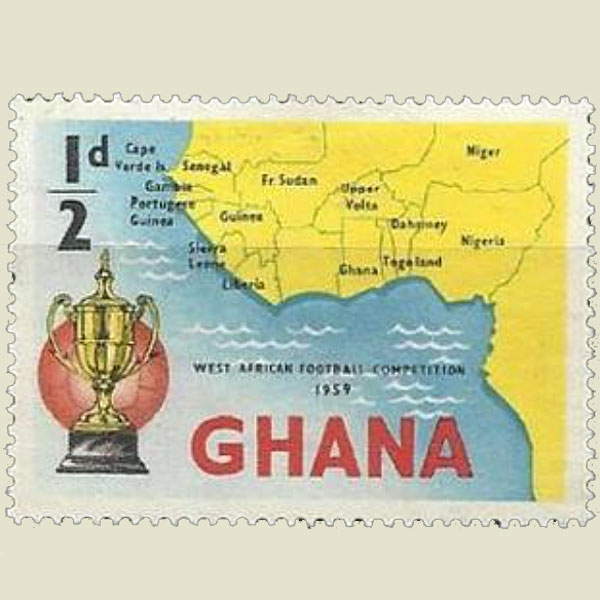 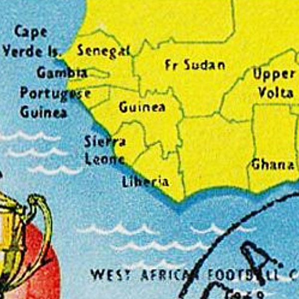 | |
GHANA 1959 | |
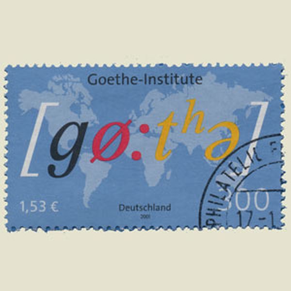
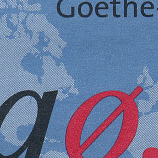
Mystery map The map in the background looks real, but does not represent a known location. |
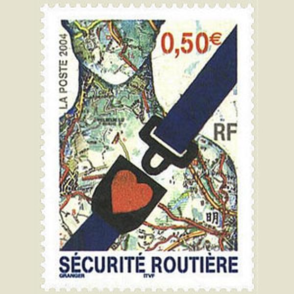 | |
FRANCE 2004 | |
Wrong border Wrong representation of the border between France and Italy. |
   | |
FRANCE 1955 | |
Missing continent All Europe was forgotten on this globe. |
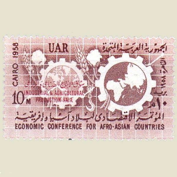 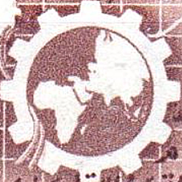 | |
UNITED ARAB REPUBLIC 1958 | |
Wrong country The stamp commemorates the stay of Che Guevara in the formal Belgian Congo, but shows a map of Congo-Brazzaville. |
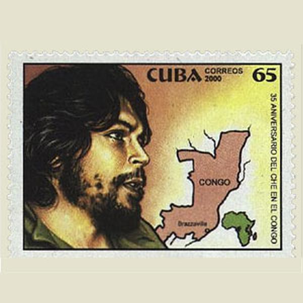 | |
CUBA 2000 | |
Forgotten country The territory of Israël was included in Jordania |
  | |
QATAR 1972 | |
Missing island The island of Madagascar was forgotten on this map. See correct map on other stamp. |
    | |
GERMANY 1991 | |
Missing island The island of Madagascar was forgotten on this map. See correct map on other stamp. |
    | |
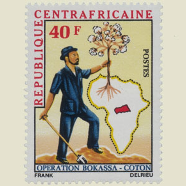
CENTRAL AFRICAN REPUBLIC 1975 | |
Wrong countryname It is not England, but the United Kingdom which is a member of the European Union. |
 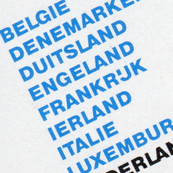 | |
NETHERLANDS 1979 | |
Wrong countryname It is not England, but the United Kingdom which is a member of the European Union. Correct on the other stamp. |
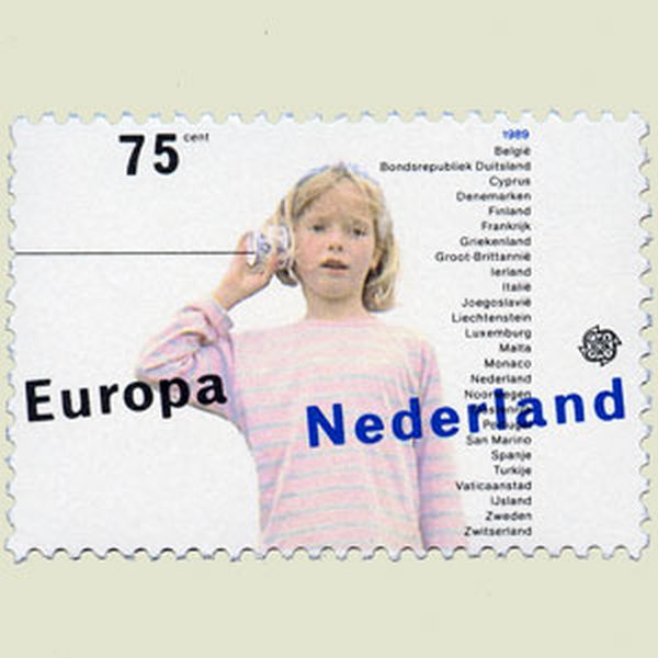 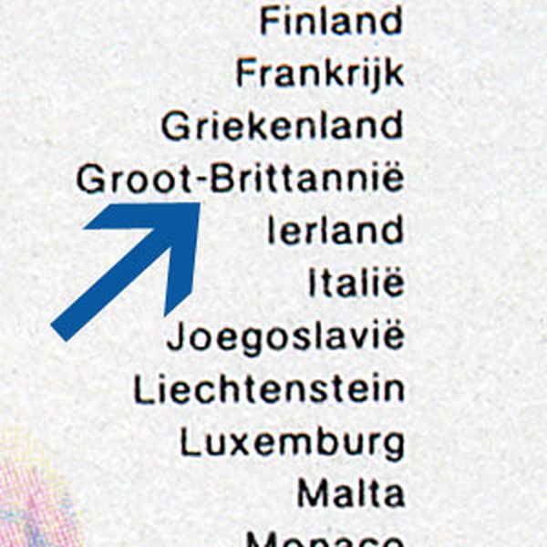   | |
NETHERLANDS 1989 | |
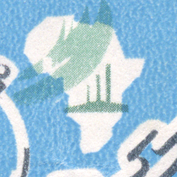
Missing island The island of Madagascar was forgotten on this map of Africa. |
 | |
UNITED ARAB REPUBLIC 1961 | |
Ownership As in other stamps, Argentina claims the ownership of the Malvinas. From their point of vue of course, this is not an error. |
 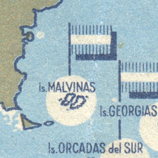 | |
ARGENTINA 1964 | |
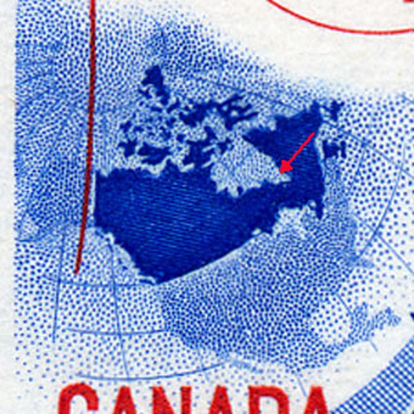
Distorsion Wrong representation of the Hudson Bay. Compare with the map. |
 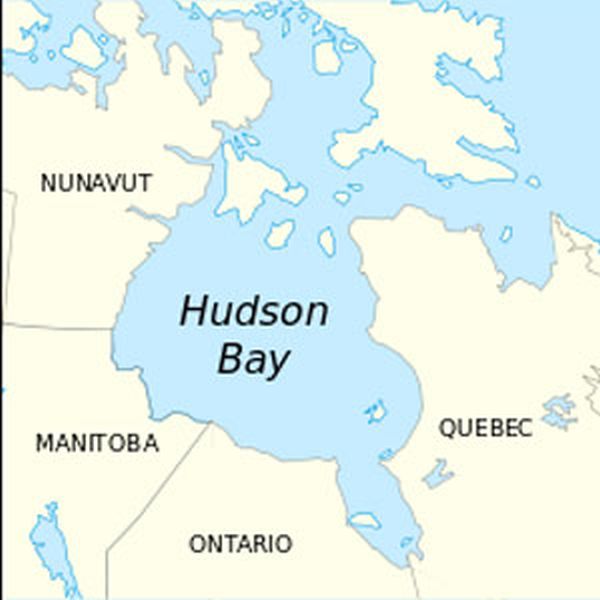 | |
CANADA 1966 | |
Wrong position The position of the island Madagascar is not correct, comparing to Africa. |
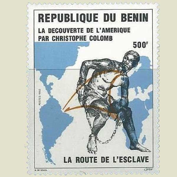
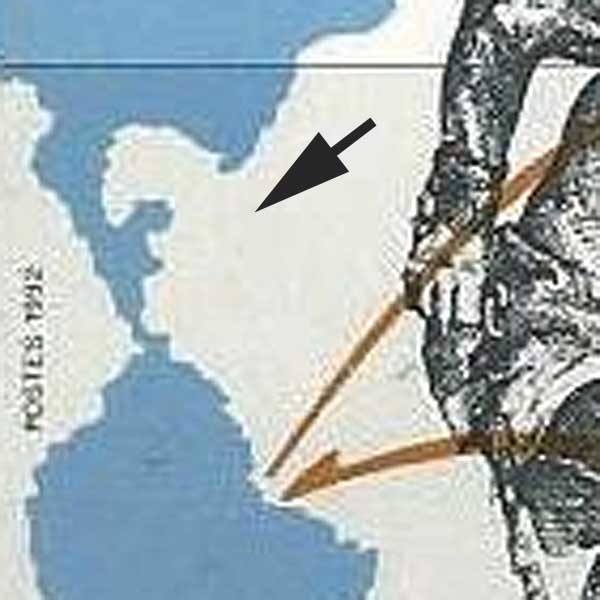
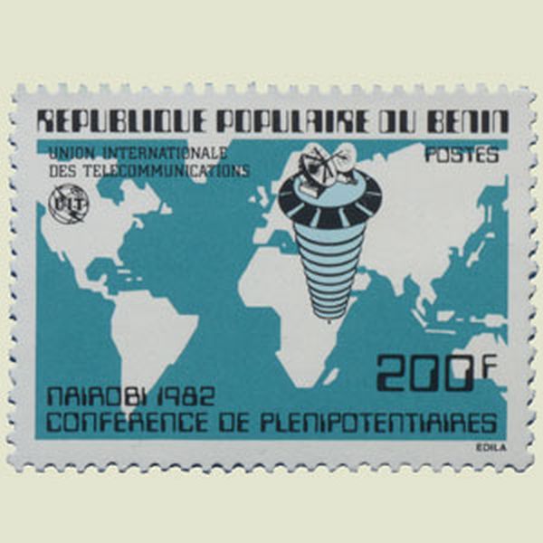 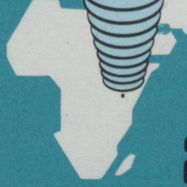  | |
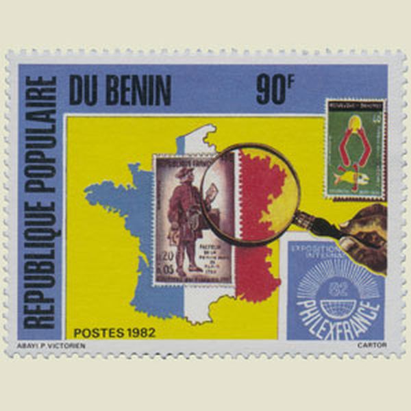
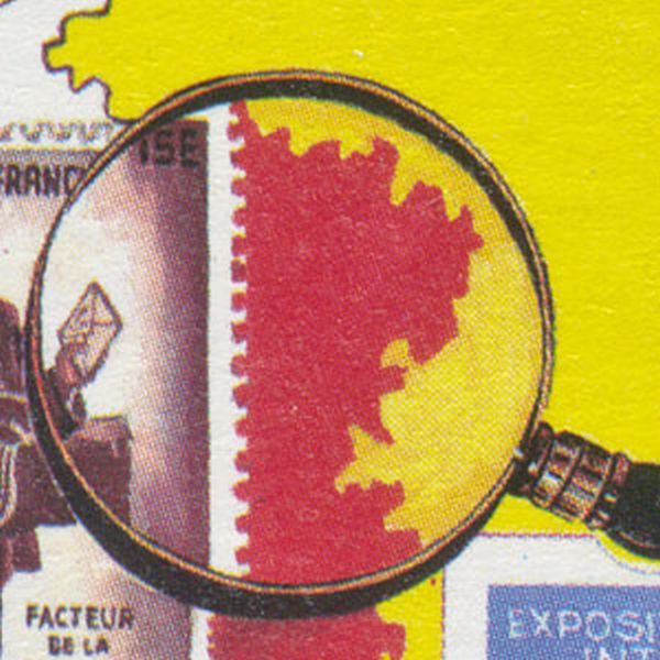
BENIN 1982 | |
Wrong border Wrong design of the border between France and Italy. |
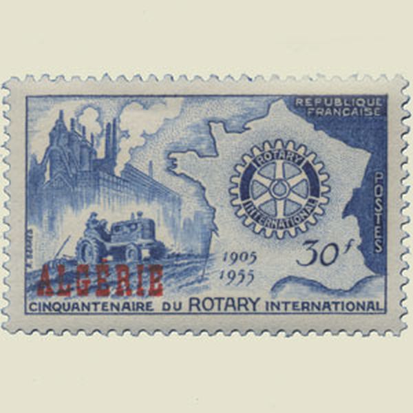 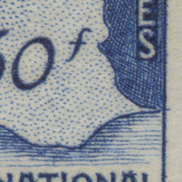  | |
ALGERIA 1955 | |
Wrong map The map of Germany shows only the formal West-Germany. |
  | |
GREECE 1992 | |
Missing island The island of Madagascar was forgotten. |
 | |
LIBYA 1990 | |
Missing island The island of Madagascar was forgotten. |
 | |
GUINEA 1962 | |
Extended map The Republic of Ireland added Ulster (North Ireland)to its territory. |
  | |
IRELAND 1922 | |
Wrong borders Borders of Greece and Italy are not correct |
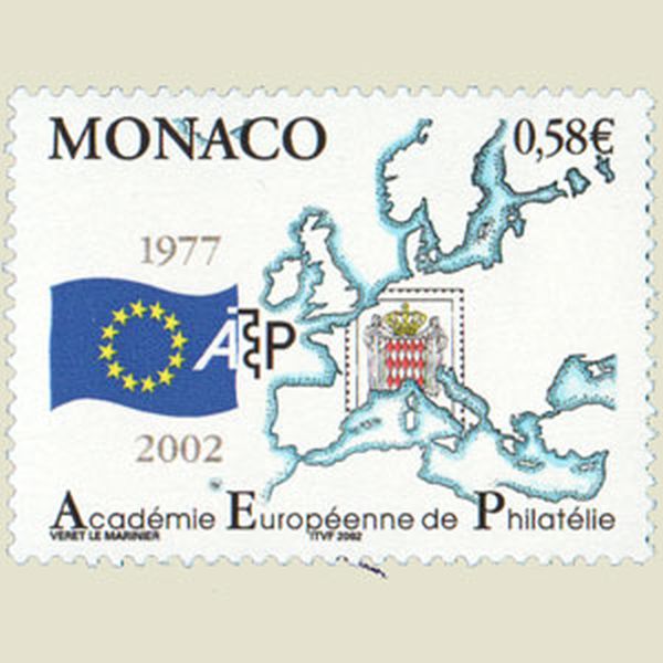 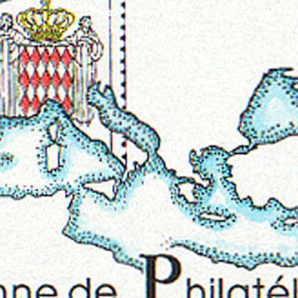  | |
MONACO 2002 | |
Too the left The map on the stamp is slightly turned to to left comparing to the exact situation. |
  | |
UNITED STATES OF AMERICA 1955 | |
Missing island The island of Madagascar was forgotten. |
  | |
CENTRAL AFRICAN REPUBLIC | |
Missing countries Greenland and Iceland are missing on this stamp. |
  | |
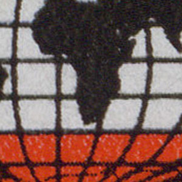
GERMANY 2001 | |
Missing island The island of Madagascar was forgotten, and the Gibraltar strait is much too wide. |
  | |
ITALY 1989 | |
Error in country name Wrong : Afghanestan - Correct : Afghanistan |
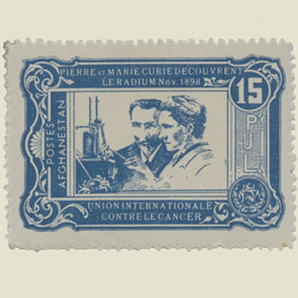 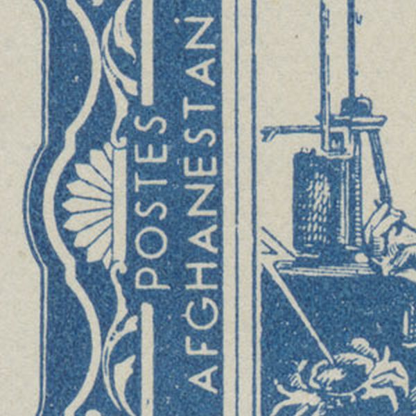 | |
AFGHANISTAN 1938 | |
Wrong number The zero meridian is the Greenwich one, not the meridan of Bogota. |
 | |
COLOMBIA 1956 | |
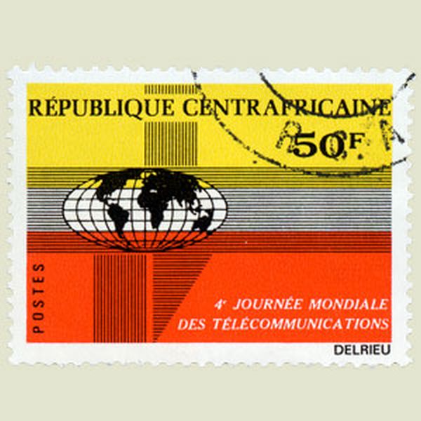
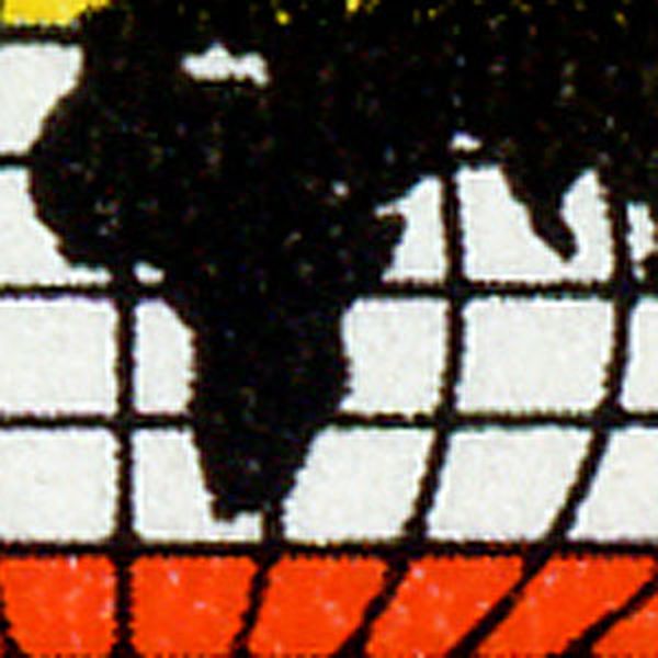
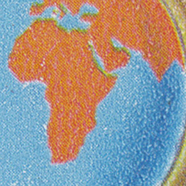
Missing island The island of Madagascar was forgotten. |
 | |
CENTRAL AFRICAN REPUBLIC | |
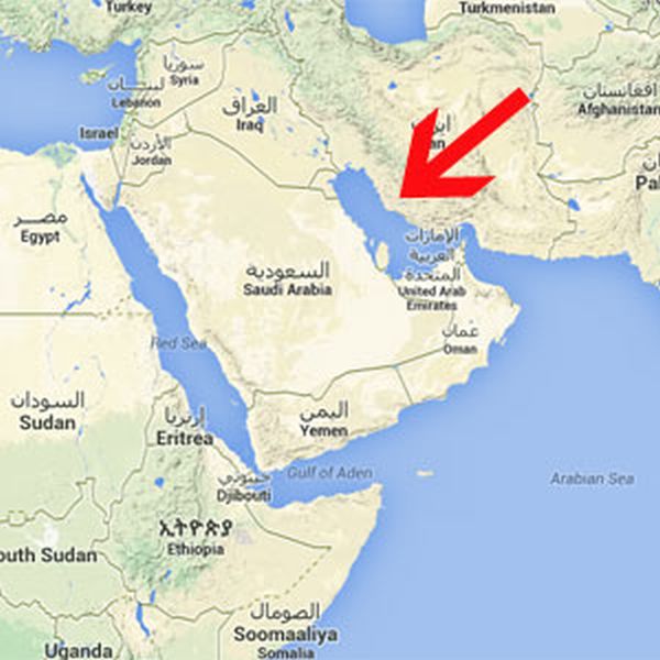
Wrong location The location of the Von Neumayer Polar Research Station was modified. The stamp still shows the original location, the red arrow the real location. |
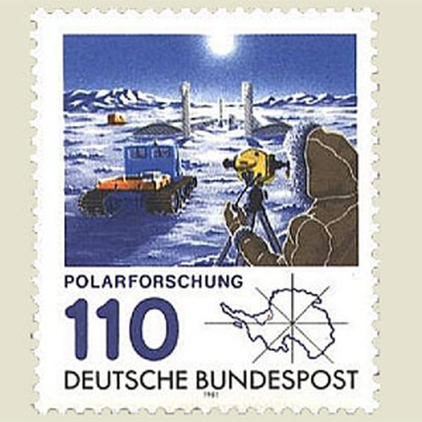 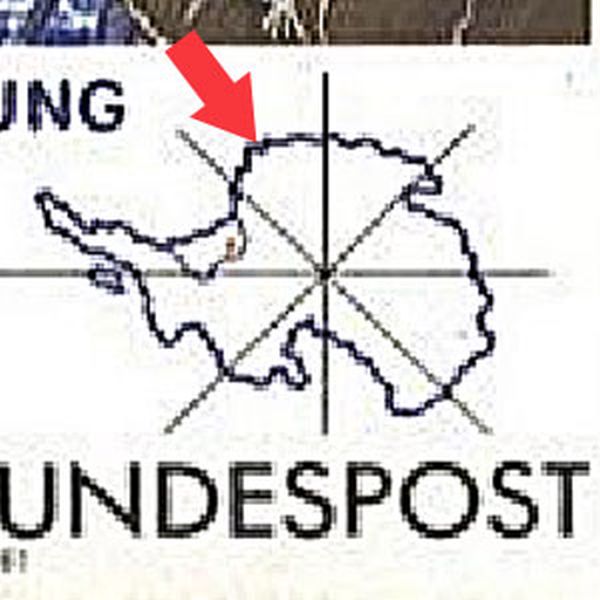 | |
GERMANY 1981 | |
Super sized The USA are 100 times larger than Liberia, but on the stamp their size is almost equal. |
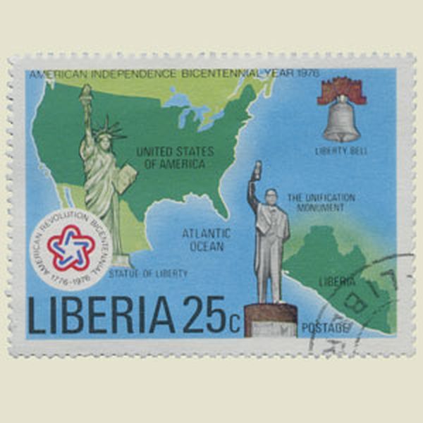 | |
LIBERIA 1976 | |
Not equal Liberia is much bigger than Sierra Leone, but on the stamp they have almost the same size. |
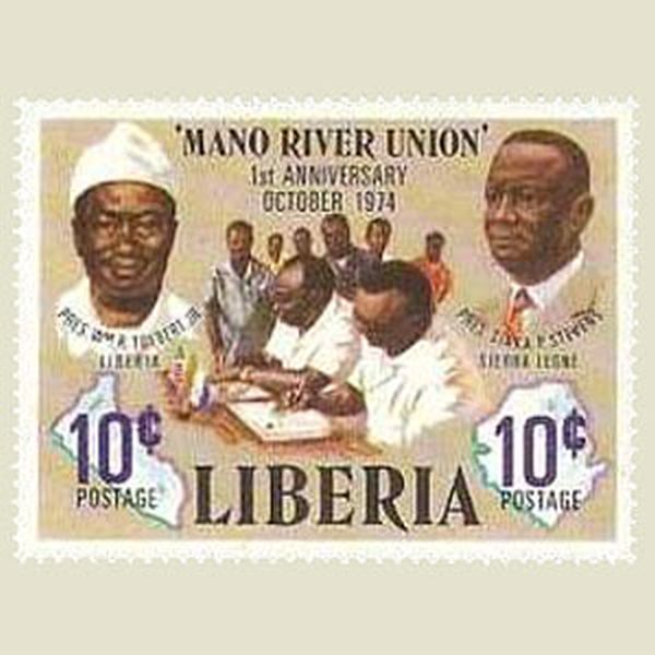 | |
LIBERIA 1975 | |
Not the same size Norfolk (left) is 50% smaller than Pitcairn (right), although they have been represented at the same size. Furthermore the map of Norfolk is slightly inclunated. |
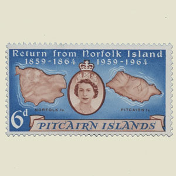 | |
PITCAIRN ISLANDS 1961 | |
Not visible The Florida peninsula shouls be visible on the stamp. |
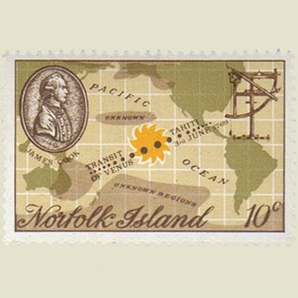  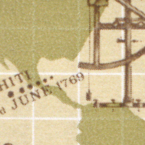 | |
NORFOLK 1969 | |
Big continent Australia is almost as large as North America, and the design of Europe could have been better. |
 | |
GUATEMALA 1946 | |
Wrong position The equator does not cross the American continent in Middle-America, but lower. |
 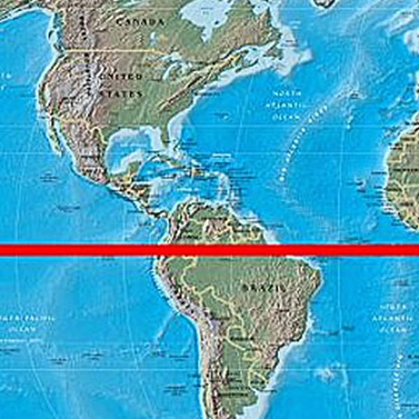 | |
DOMINICAN REPUBLIC 1940 | |
Wrong position Wrong : 45°05' - Correct : 46°05'. |
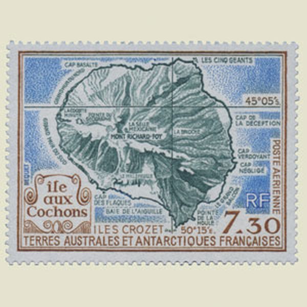 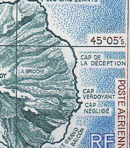 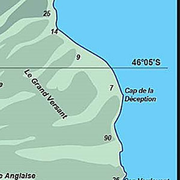  | |
FRENCH ANTARTIC TERRITORIES 1990 | |
Missing territories The Palestinian territories (Westbank and Gazah) were forgotten. |
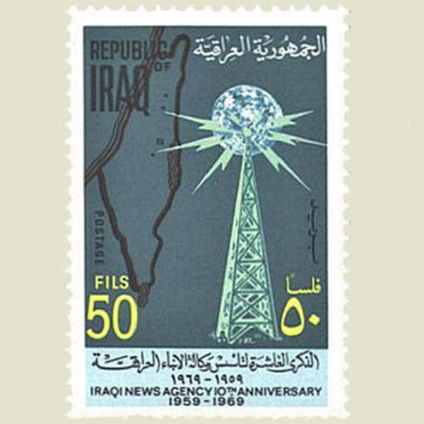 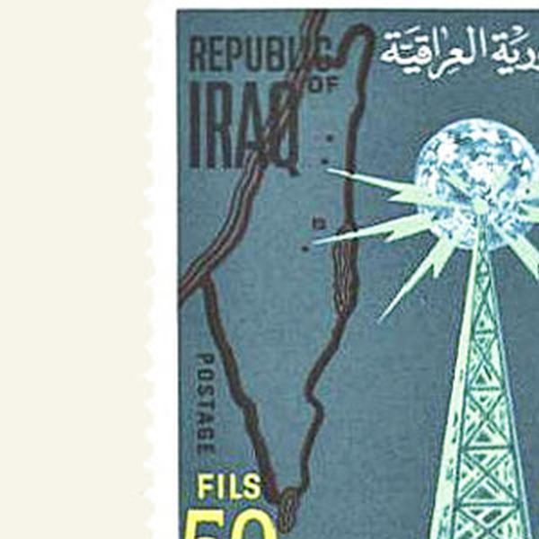  | |
IRAQ 1969 | |
Wrong border The border between France, Germany and Switzerland is completely inaccurate. |
   | |
BENIN 1982 | |
Errors in map Borders of different countries are not correct. |
   | |
MONACO 2000 | |
Poor map Strange shape and missing name of Luxemburg, and badly featured border between Belgium and Germany. |
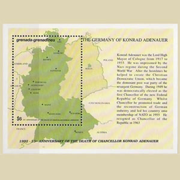 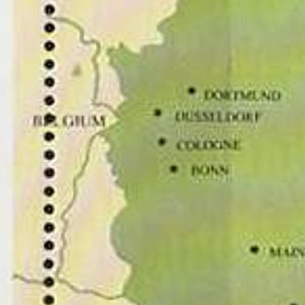  | |
GRENADA GRENADINES 1992 | |
Wrong position The latitude line 177°E was not positionned correctly |
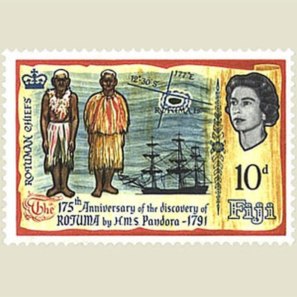 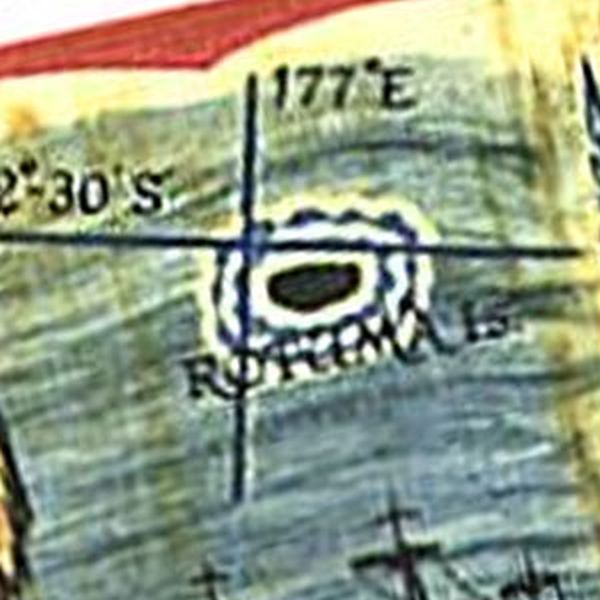 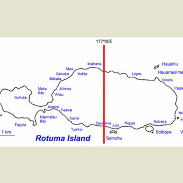 | |
FIJI 1966 | |
Dispute through stamps Argentina claims the Falklands, as they have done before on other stamps. |
  | |
ARGENTINA 1982 | |
Missing island The island of Madagascar is missing |
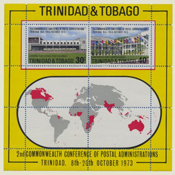 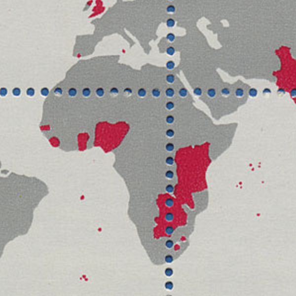  | |
TRINIDAD AND TOBAGO 1973 | |
Wrong map The Persian Gulf was omitted on the stamp. |
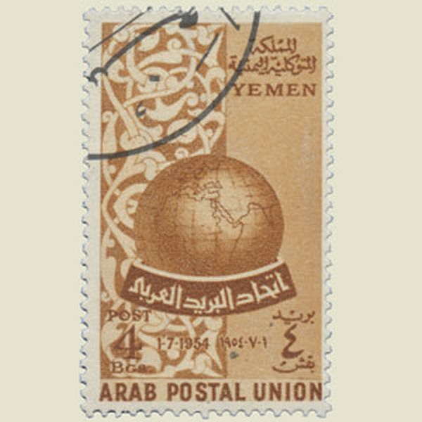   | |
YEMEN 1954 | |
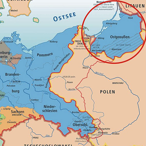
Under water The present Russian part of East Prussia (Königsberg) has disappeared under the water of the Baltic sea. |
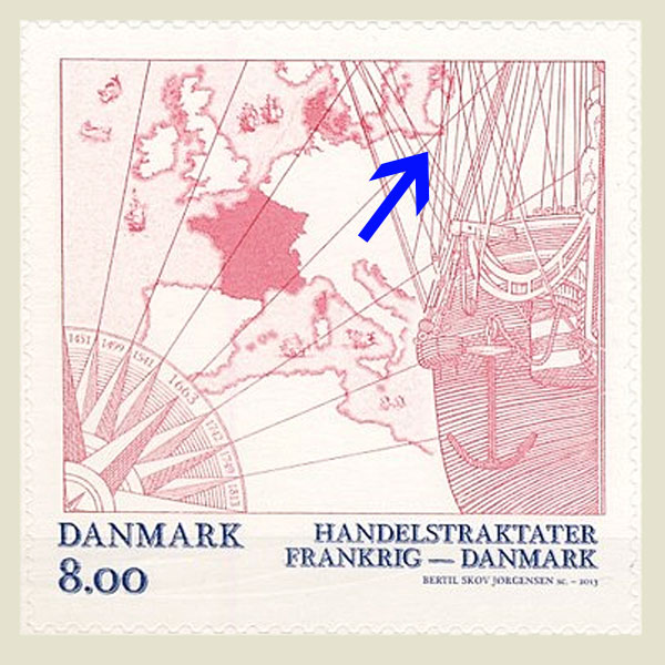   | |
DENMARK 2013 | |
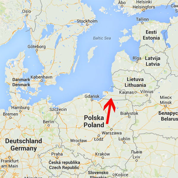
Missing province The present Russian part of East Prussia (Königsberg) has disappeared under the water of the Baltic sea. |
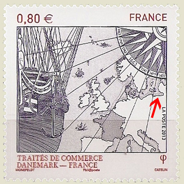   | |
FRANCE 2013 | |
Missing continent Antartica is missing |
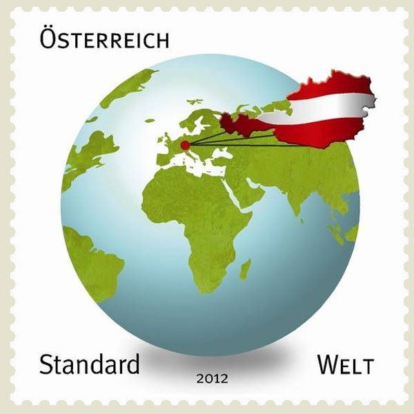 | |
AUSTRIA 2012 | |
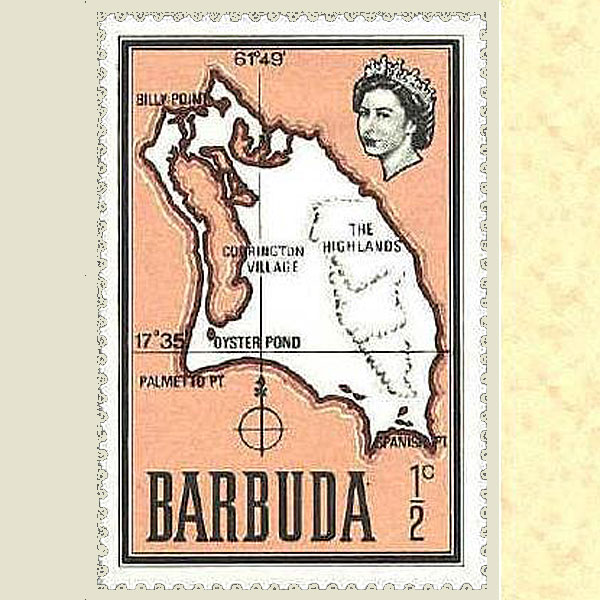
Wrong shape and position The shape and the orientation of the Barbuda island are wrong on this old map, the position (17°35 - 61°42) however is correct |
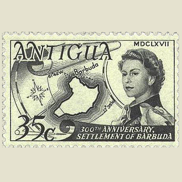  | |
ANTIGUA | |
Missing island Combined issue Belgium-Netherland. On the Belgian stamp, the island of Marken is missing, correct on the Dutch stamp. |
  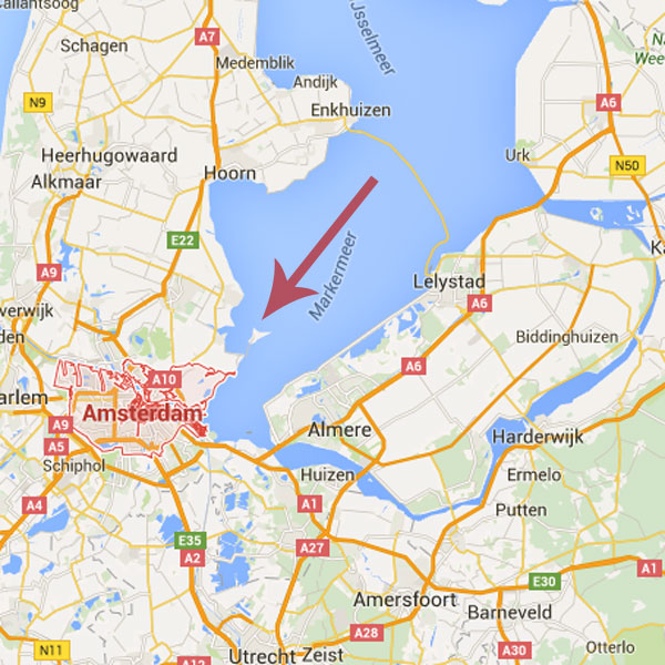 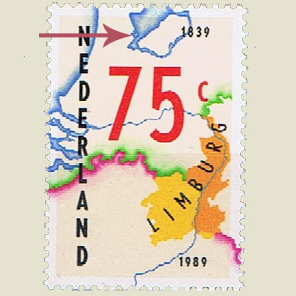 | |
BELGIUM 1989 | |
Wrong order The stamp designer first wrote GAMBIA insead of THE GAMBIA. He corrected his error without changing the afphabetical order of the countries. |
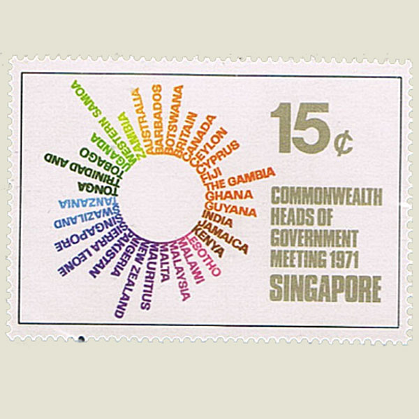 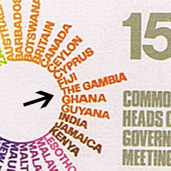 | |
SINGAPORE 1971 | |
Not an island As North-Korea was not featured, South-Korea seems to be an island. |
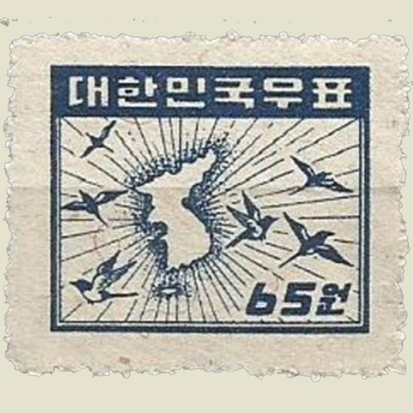 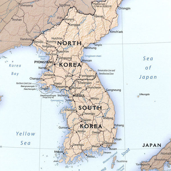 | |
SOUTH KOREA 1949 | |
Too big The size of the island of Jersey is out of proportion |
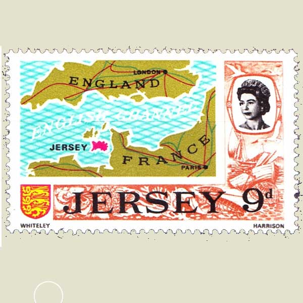 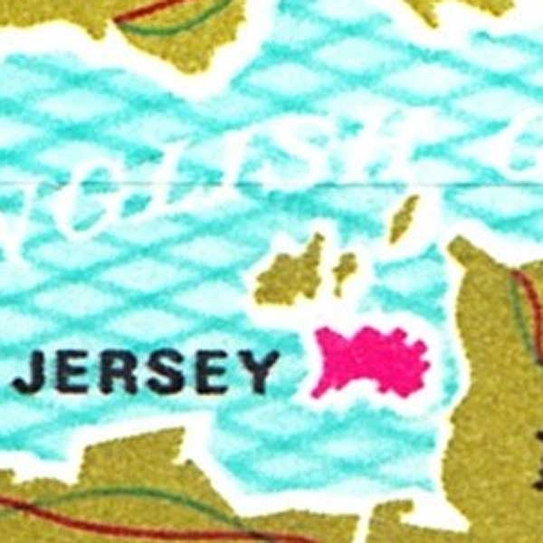  | |
JERSEY 1969 | |
Too big The size of the island of Jersey is out of proportion |
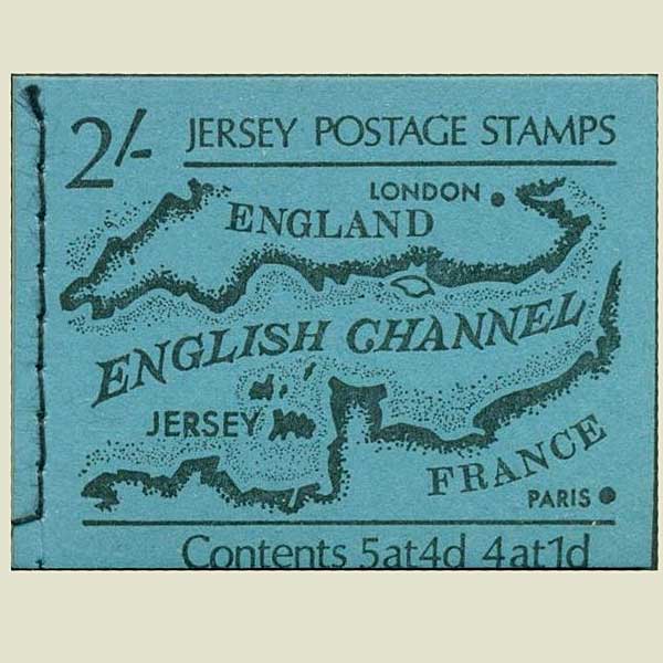  | |
JERSEY 1969 | |
Drifting continents All the continents are on the front side of the globe |
  | |
BENIN 1978 | |
Missing island Cuba is missing on this map |
   | |
BENIN 1992 | |
Rising sea level The Netherlands almost completely under water, maybe like it would be in 2100 ? |
   | |
TURKEY 2012 | |
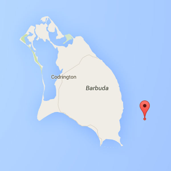
In the neighbourhood The correct position shown on the stamp is not 17°35 - 61°49 but 17°36 - 61°49 |
 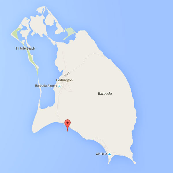 | |
BARBUDA | |
Inverted map The Norway map in the background is inverted |
  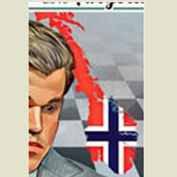 | |
ANGOLA 2019 | |
In another continent Mount Huascarran is not located in Nepal, but in Peru |
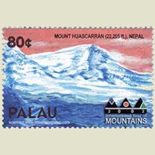 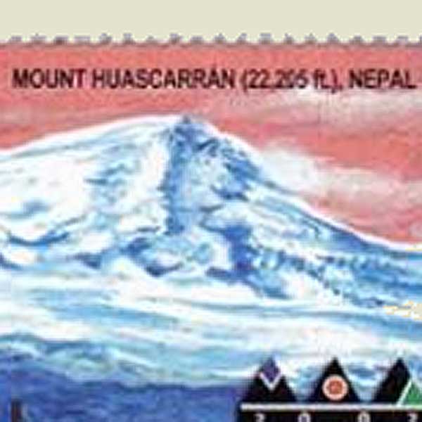 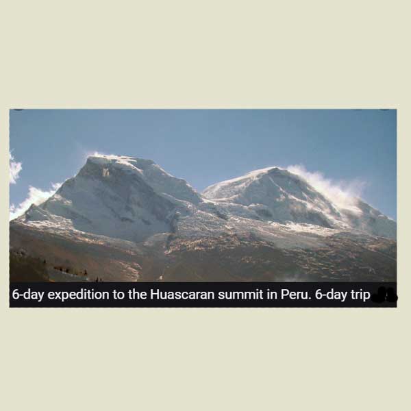 | |
PALAU 2002 | |
Political statement? Modify the name of Israel into Palestina will certainly not promote peace. |
  | |
UNITED ARAB REPUBLIC 1961 | |
Political statement? Israël has been replaced by Palestina |
  | |
UNITED ARAB REPUBLIC 3317 | |
Unknown island Unknown island near to Africa |
   | |
BULGARIA 2005 | |
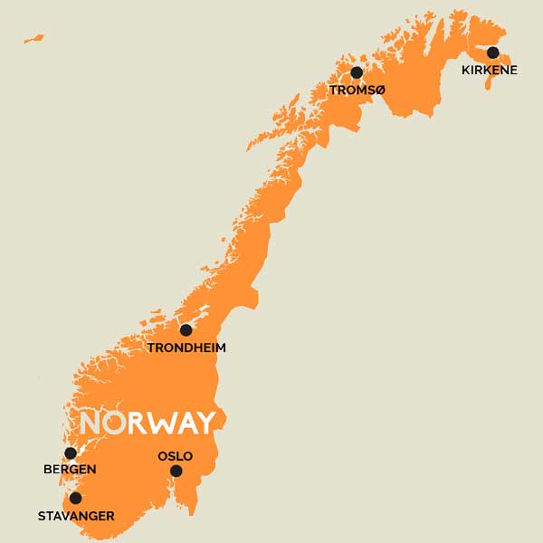
Wrong direction The direction of the next continent after Africa should have been Asia, before Australia |
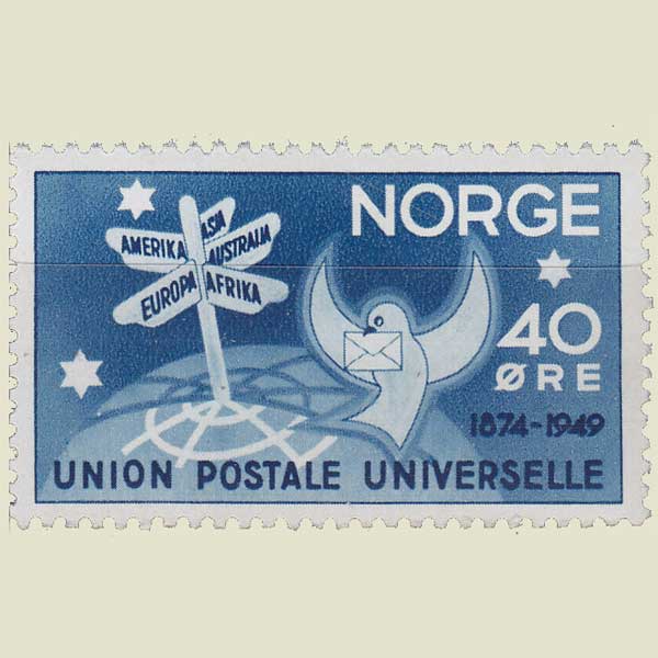 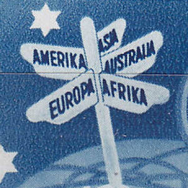 | |
NORWAY 1949 | |
Continental shift All the continent have been located on the same side of the earth |
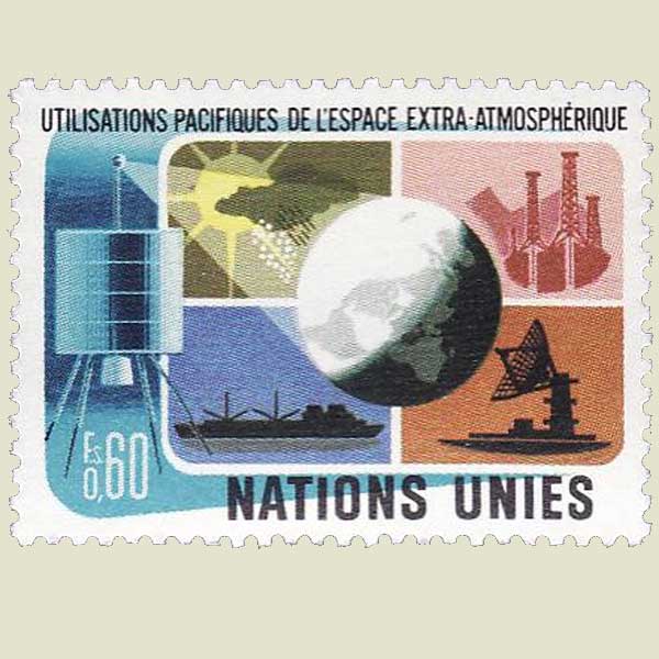  | |
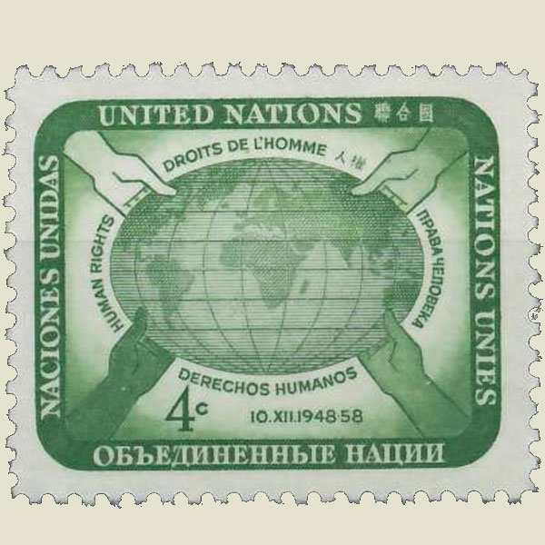
UNITED NATIONS 1975 | |
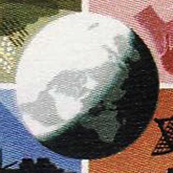
Continental shift All the continents have drifted to the North |
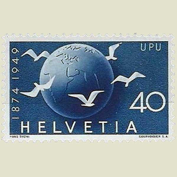  | |
SWITZERLAND 1949 | |
Missing continent Antartica is missing |
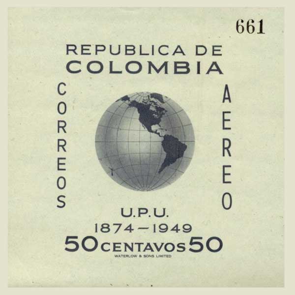 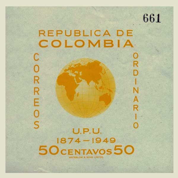 | |
COLOMBIA 1949 | |
Forgotten Cuba is missing |
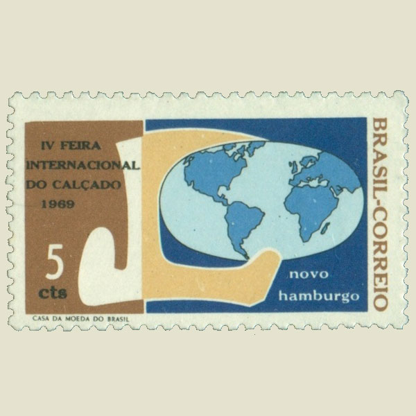 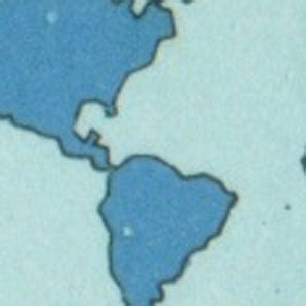 | |
BRAZIL 1969 | |
Too close Europe and America are much too close |
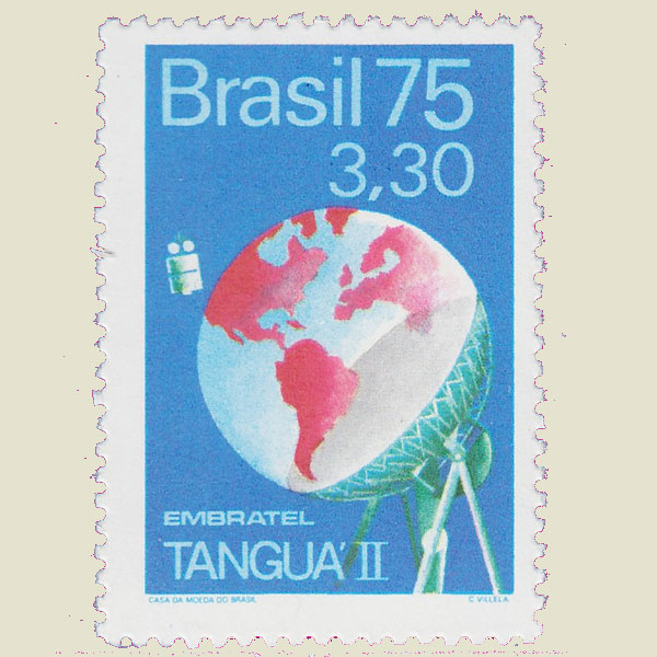 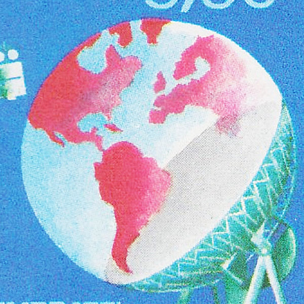 | |
BRAZIL 1975 | |
Missing continent Antartica is missing |
 | |
CHILE 1973 | |
Missing continent Antartica was forgotten |
 | |
CANADA 1964 | |
On the move Continents on the move |
  | |
UNITED NATIONS 1950 | |
Missing continent Antartica is missing |
 | |
UNITED NATIONS 1950 | |
Missing island Where is Madagascar ? |
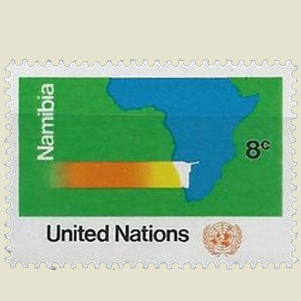 | |
UNITED NATIONS 1973 | |
Oversized Laos is oversized on this globe |
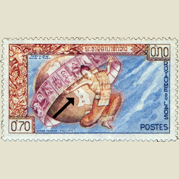  | |
LAO 1962 | |
Wrong country This railway is not located in Switzerland, but in Germany. |
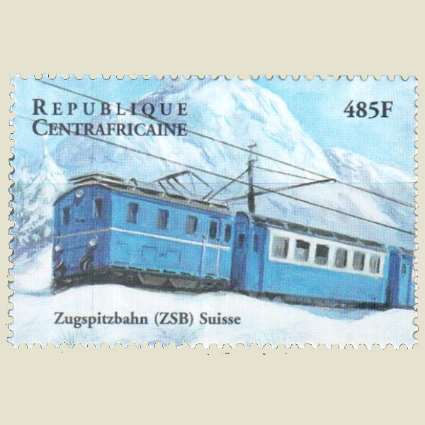 | |
CENTRAL AFRICAN REPUBLIC 2000 | |
Missing continent Antartica is missing |
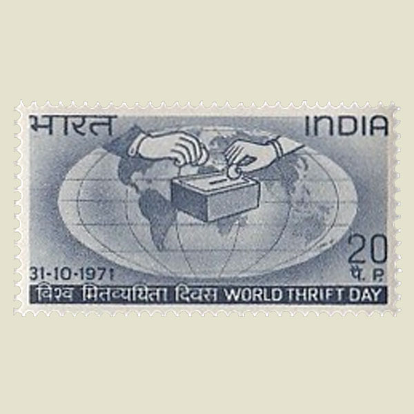 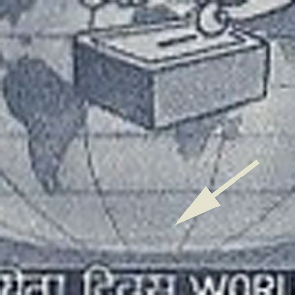 | |
INDIA 1971 | |
Missing continent Antartica is missing |
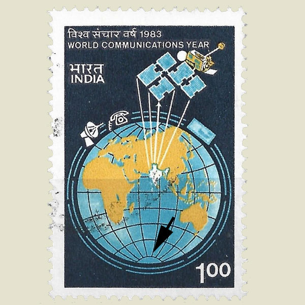 |
INDIA 1983 |